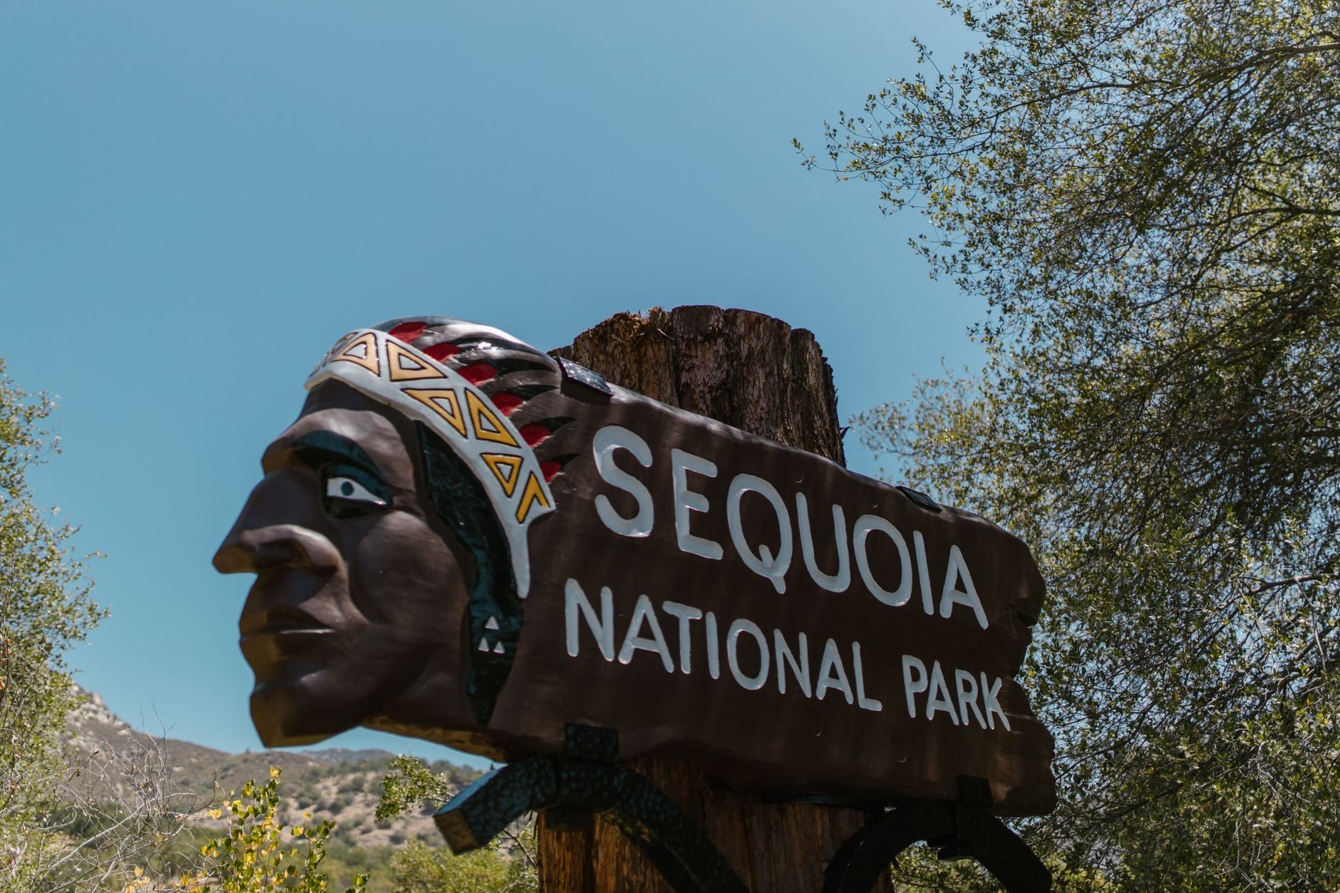
The drive from San Francisco to Sequoia National Park takes roughly 5 to 6 hours and covers about 280 miles, crossing the Bay Area, the flat Central Valley, and finally the switchbacks of the Sierra Nevada foothills. It's a drive-first destination: no train goes to the park, the bus-and-shuttle combo takes twice as long as driving, and there's no fuel inside the park boundaries. This guide covers the two realistic routes, which entrance to plug into your GPS, the winter chain rules, where to break up the drive, and how to structure the trip once you're there.
San Francisco to Sequoia at a Glance: Distance, Drive Time and Which Entrance
Two entrances serve the two parks, and the one you pick decides your route. Sequoia's Ash Mountain entrance sits at the end of CA-198 east of Visalia — about 280 miles and 5.5 to 6 hours from San Francisco in normal traffic. Kings Canyon's Big Stump entrance sits at the end of CA-180 east of Fresno; the National Park Service lists that drive from San Francisco at 250 miles and about 4 hours 30 minutes. Visalia itself is just 36 miles (45 minutes) from Ash Mountain, which is why nearly every Sequoia trip funnels through it.
| Route | Entrance | Distance | Drive time |
|---|---|---|---|
| CA-99 S to CA-198 E, via Visalia | Ash Mountain (Sequoia) | ~280 mi | 5-6 hrs |
| CA-99 S to CA-180 E, via Fresno | Big Stump (Kings Canyon) | 250 mi | ~4 hrs 30 min |
| CA-1 coastal detour via Monterey | Ash Mountain (Sequoia) | ~350 mi | 8-9 hrs |
The decision most first-timers miss: don't just type "Sequoia National Park" into your GPS and go. Aim for CA-198 through Visalia if the Giant Forest and General Sherman Tree are the goal, or CA-180 through Fresno if you're starting on the Kings Canyon side — both roads meet inside the parks on the Generals Highway, so you can enter one way and leave the other. Whichever you choose, the $35 private-vehicle pass is valid for 1-7 days and covers both parks plus the Hume Lake District of Sequoia National Forest. There's no need to pay twice. For the full picture on transport options, see the park's getting-there guide.
Best Driving Routes from San Francisco to Sequoia National Park
Every realistic route starts the same way: I-80 east to I-580 east over the Altamont Pass, then I-205 back to I-5 or CA-99 south through the Central Valley. The differences begin about two hours in, when you commit to Visalia or Fresno.
Route 1: CA-99 South to CA-198 East via Visalia
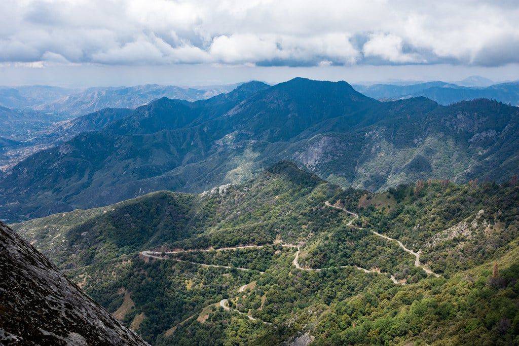
This is the standard Sequoia route. CA-99 is the Central Valley's main street — Modesto, Merced, Fresno and Visalia all sit on it, so gas, fast food and restrooms are never more than a few minutes away. You leave the highway at Visalia and follow CA-198 east for the last 36 miles to the Ash Mountain entrance. The trade-off comes after the entrance station: the NPS warns that the Generals Highway beyond Ash Mountain is narrow and winding, climbing from 1,700 feet to over 6,000 with tight switchbacks and steep drop-offs. Take it slow, use the pullouts, and don't ride the bumper ahead of you.
Route 2: CA-99 South to CA-180 East via Fresno
Driving from Fresno via CA-180 adds flexibility. The NPS calls Highway 180 the preferred route for longer vehicles — it's straighter, less steep and wider than 198 — so RV and trailer drivers should use it by default. It delivers you to the Big Stump entrance and Grant Grove, home of the General Grant Tree, about an hour's drive from the Sequoia sights on the Generals Highway. Coming from San Francisco, the 180 approach is also the shorter, faster drive on paper; you simply trade 30 minutes of highway for an hour of in-park driving if your base is Sequoia's Giant Forest.
Alternates: I-5 and the Coast
I-5 south is the third option — roughly 285 miles cutting west of CA-99, with lighter traffic on summer weekends and holidays but noticeably fewer places to stop for food or fuel. It rejoins the approach roads near the Fresno area. The coastal CA-1 route through Monterey is a different animal: about 350 miles and 8-9 hours of driving, best saved for a loop trip where the coast is the point rather than a detour.
Before You Drive: GPS Warnings, Fees and Park Road Rules
The NPS has a blunt warning about navigation apps: online maps sometimes route drivers onto remote dirt roads that skip the entrance stations, and those roads can leave you stranded with a damaged vehicle. Two settings matter. First, turn off the "avoid tolls" feature — left on, it can push you onto bad roads, and there are no tolls on the standard routes anyway. Second, never accept a route that leaves pavement before the park entrance. Navigate to CA-198 (Sequoia) or CA-180 (Kings Canyon) and stay on them to the end.
The entrance fee is $35 per private vehicle, valid 1-7 days for both parks. Entrance stations take credit, debit and mobile payment only — no cash, though you can pay cash at the Foothills or Kings Canyon Visitor Centers if you stop before entering. An $80 America the Beautiful pass covers every national park for a year, worth it if Yosemite or Death Valley is also on your list. Current hours and entry fees are worth a quick check before you leave.
Vehicle length matters on the Generals Highway. Vehicles longer than 24 feet are not advised between the Foothills Visitor Center and Potwisha, and longer than 22 feet between Potwisha and the Giant Forest Museum. Crystal Cave Road caps out at 22 feet combined length. If you're renting an RV from San Francisco, plan on the CA-180 entrance and check these limits before you book.
The rule that catches people: there are no gas stations or EV chargers inside the park boundaries. A seasonal station at Stony Creek Village on the road between the two parks exists, but don't build a plan around it — fill up in Visalia or Fresno, or at least keep a half tank in reserve. And on summer Fridays, Saturdays and holidays from Memorial Day to Labor Day, lines at the entrance stations stretch; arrive before 9 a.m. or expect to idle.
Best Time of Year for the Drive (and Winter Chain Rules)
Summer — June through August — is the easiest season for the drive itself: all roads open, grove temperatures in the 50s-to-70s Fahrenheit range, and a free shuttle running to the Giant Forest, Moro Rock and Lodgepole so you can park once and stop worrying about it. The price is crowds, plus those entrance-station lines on weekends. One summer quirk to plan around: Crescent Meadow Road closes to private vehicles during certain daytime hours, so the shuttle is the only way to reach Moro Rock and Tharp's Log then.
Fall and spring split the difference. September and October bring thin crowds and mild driving weather; April and May add roaring waterfalls from snowmelt, though the rivers run cold and dangerously fast, and late-season storms can still dust the high country. Our full season-by-season guide breaks down weather, crowds and prices month by month.
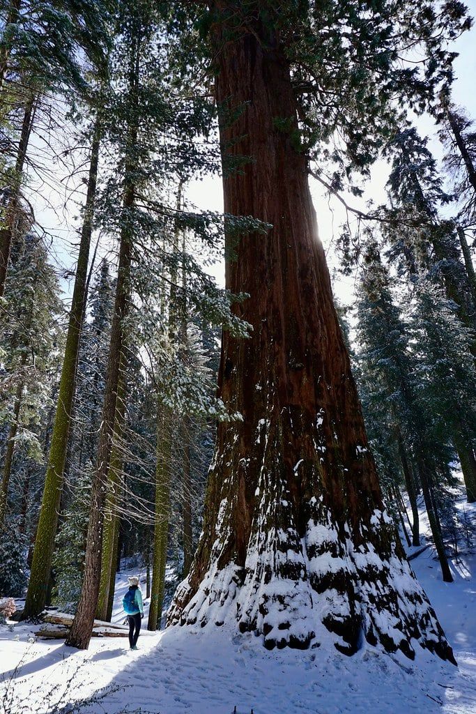
Winter changes the math. Tire chains may be required on park roads any time it snows — usually from late fall through spring — and you can buy or rent them near the entrance stations, though renting on a storm day means competing with everyone else who waited. Storms can close the Generals Highway between Hospital Rock and the Giant Forest outright, cutting off the big trees from the foothills. Call the park's road-conditions line at (559) 565-3341 the morning you drive. The upside: snow-draped sequoias, snowshoeing and cross-country trails, and the foothills stay mild enough that Potwisha Campground stays open year-round. Whenever you go, leave San Francisco by 7 a.m. — you'll beat both Bay Area traffic and the entrance line.
Can You Do a Day Trip from San Francisco? (And How Many Days You Need)
The honest math: 5 to 6 hours each way means 10-12 hours behind the wheel for, at best, three or four daylight hours among the trees. It can be done — leave at 4 a.m., arrive by 10, see General Sherman and Moro Rock, and drive back through the night — and in summer, with two drivers and a tight list, some people pull it off. Most regret it. The mountain roads are the last stretch you want to drive exhausted, after dark, at the end of a 12-hour day.
Book one night at minimum. Two to three days is the sweet spot: enough time for the Giant Forest, Moro Rock, Crystal Cave and a dip into Kings Canyon without watching the clock. In winter, treat a day trip as off the table entirely — between chain requirements, possible highway closures and early sunset, the margin for error disappears.
Best Stops to Break Up the Drive
The direct route has a rhythm: Bay Area sprawl, two hours of flat valley farmland, then the foothills. Break it in the right places and the drive stops feeling like a slog.
Livermore and the Central Valley Legs
Livermore, on I-580 about 45 minutes from San Francisco, is the last wine-country stop before the valley — a reasonable spot for coffee or a tasting-room detour if you're not driving on. From there, the CA-99 corridor towns of Modesto and Merced are pure utility stops: reliable gas, fast food, and restrooms every few miles. Don't overthink them; stop when the tank or the kids demand it.
Fresno: Worth an Hour on the CA-180 Route
Fresno is more than a refueling point. The Forestiere Underground Gardens are a strange, wonderful complex of subterranean courtyards and rooms hand-carved by one Sicilian immigrant over decades, and the Shinzen Japanese Garden makes a calm leg-stretch. If you're taking CA-180 east, both sit roughly on your way to the Big Stump entrance.
Visalia: The Last Real City
Visalia is where the trip pivots from highway to mountain. It's the last place with a full range of hotels, restaurants, supermarkets and rental-car services, and it's 36 miles — about 45 minutes — from the Ash Mountain entrance. Top off the tank here even if you're three-quarters full; there's no fuel inside the park. It's also the natural overnight point if you're arriving late.
Three Rivers: The Gateway Town
Three Rivers, population small, sits at the base of the winding climb on CA-198, fifteen minutes from the entrance station. It has the closest gas to the park, a handful of cafés and lodges, and a visitor center where you can buy Crystal Cave tickets in advance (they're not sold at the cave). Expect prices to rise with the proximity — it's the classic gateway-town premium.
One more option if time is generous: a coastal loop via Monterey and Pinnacles National Park covers roughly 450 miles against the direct route's 280 — about 200 extra miles and a full extra day. Lovely, but only worth it when the coast is the destination, not a detour.
Getting to Sequoia from San Francisco Without a Car
It's possible, and it takes twice as long as driving. The workable combo: Amtrak's San Joaquins train to Hanford (or Greyhound direct to Visalia), then an Amtrak connecting bus to the Visalia Transit Center, then the Sequoia Shuttle into the park. Total transit time runs about 10 hours 49 minutes door to door, at a fare of roughly $29-50 — versus 5 hours and a tank of gas by car. The shuttle fare into the park is about $20 round trip.
Two catches decide everything. The Sequoia Shuttle runs only in summer, roughly late May through early September, plus some holiday service — in winter, your connection from Visalia is a taxi, if one will take the mountain road at all. And getting between Sequoia and Kings Canyon without a car is, realistically, not going to happen. Guided day tours from San Francisco to Sequoia are scarce; most Bay Area small-group tours run to Yosemite instead. Rideshare from Visalia up the mountain is technically possible and practically expensive, with no guarantee of a ride back down.
So the verdict is simple: rent a car. This is a drive-first park, and every alternative spends more time and money to reach a starting line that's still 36 miles from the entrance.
Where to Stay and How to Structure the Trip
Your base town is the biggest planning decision after the route. Three Rivers puts you closest to the Ash Mountain entrance; Visalia gives you more for your money but a longer commute; staying inside the park puts the trees outside your window.
| Three Rivers | Visalia | |
|---|---|---|
| Distance to Ash Mountain entrance | ~15 minutes | ~45 minutes (36 mi) |
| Lodging and dining | Small lodges and cafés, gateway-town prices | Full range of hotels and restaurants |
| Daily commute trade-off | Short but twisty mountain drive each day | Longer, but flat and easy highway |
| Best for | Maximizing time in the park | Budget and late arrivals |
Inside the park, Wuksachi Lodge is the main hotel, convenient to the Giant Forest area. Two campgrounds do the heavy lifting: Potwisha, at 2,100 feet in the foothills, is open year-round and reservable up to four months ahead; Lodgepole runs late April through November and has showers, a market and summer shuttle access — book both on recreation.gov. On the Kings Canyon side, Grant Grove Village lodging like John Muir Lodge sits about an hour from Sequoia's main sights, which makes it a good second-night base rather than a first. For more on how the two parks split, see our Kings Canyon vs Sequoia comparison.
Three trip shapes work from San Francisco. The one-night sprint: drive down Friday afternoon, check into Visalia or Three Rivers, spend Saturday morning in the Giant Forest and climb Moro Rock, and drive home Sunday morning refreshed. The two-night weekend adds Crystal Cave and Crescent Meadow without rushing. The three-day version enters via CA-180 instead: Grant Grove and the General Grant Tree — the second-largest tree in the world, reached by a short trail — then the Kings Canyon Scenic Byway, then over the Generals Highway to Sequoia's Giant Forest before looping home. Our full park itinerary guide has hour-by-hour detail. Whatever you choose, book summer lodging and campsites months ahead; the small gateway towns fill first.
Your First Hours in the Park: Top Sights After the Drive
The drive ends at the Giant Forest, and you should head straight there — the General Sherman Tree parking lot off Wolverton Road fills by late morning in summer. For the full range of options, our things-to-do guide covers everything from caves to backpacking; these four are the sights that fit a first afternoon.
General Sherman Tree and the Giant Forest
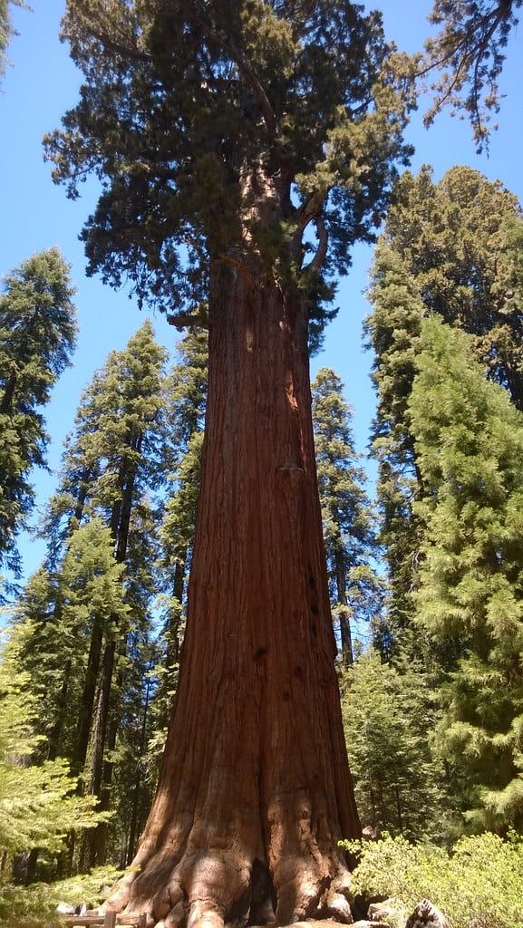
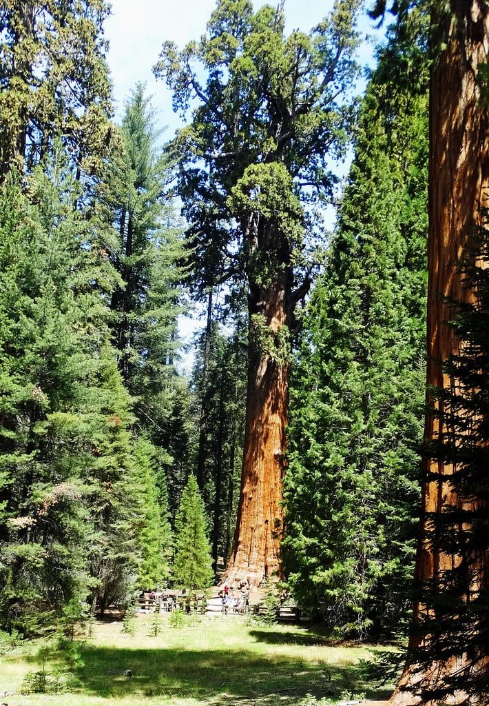
The General Sherman Tree is the largest tree on Earth by volume — 274.9 feet tall, more than 36 feet through, an estimated 2,200 years old, holding 52,508 cubic feet of wood. A paved half-mile trail drops from the main lot to its base, with a shorter accessible path from a placard parking area along the highway. From Sherman, the roughly two-mile Congress Trail loops past the President Tree and other named giants through the largest unlogged sequoia grove anywhere. Give it two hours minimum; the scale takes a while to land.
Big Trees Trail
If legs are tired from the drive, the Big Trees Trail is the gentle option: a flat, 1.2-mile paved loop around a meadow ringed with sequoias, with interpretive signs explaining how the trees depend on fire. It starts at the Giant Forest Museum, and you can finish it in 45 unhurried minutes.
Moro Rock
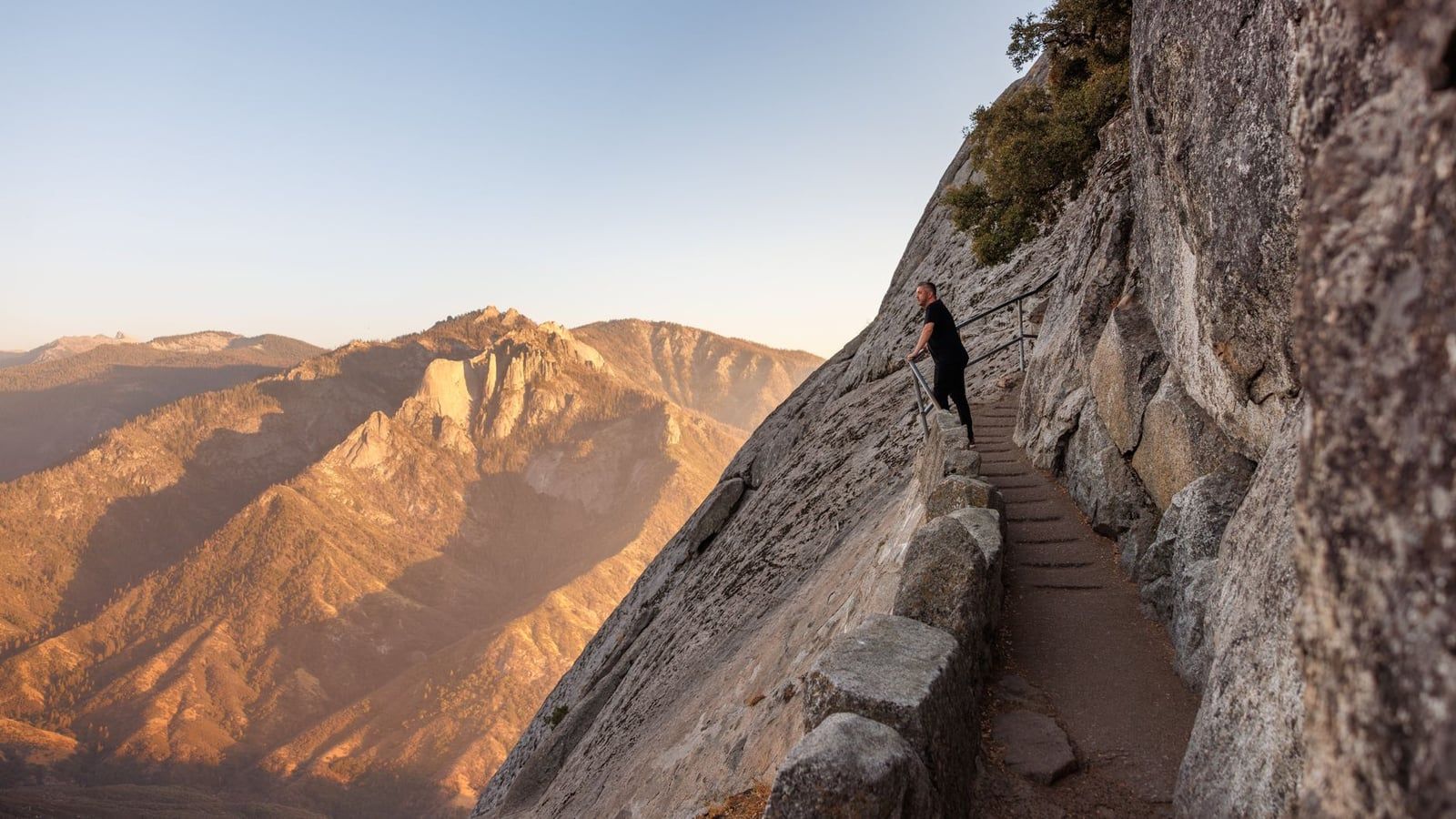
Moro Rock is a 6,725-foot granite dome with a stairway of 400 concrete steps bolted to its flank. The climb takes 15-20 minutes and pays out a 360-degree view over the Great Western Divide and the Kaweah River canyon — worth the burn in your calves, and best at the edges of the day when the crowds thin. Note again: in summer, Crescent Meadow Road closes to private vehicles at certain hours, so the free shuttle may be your only ride here.
Tunnel Log
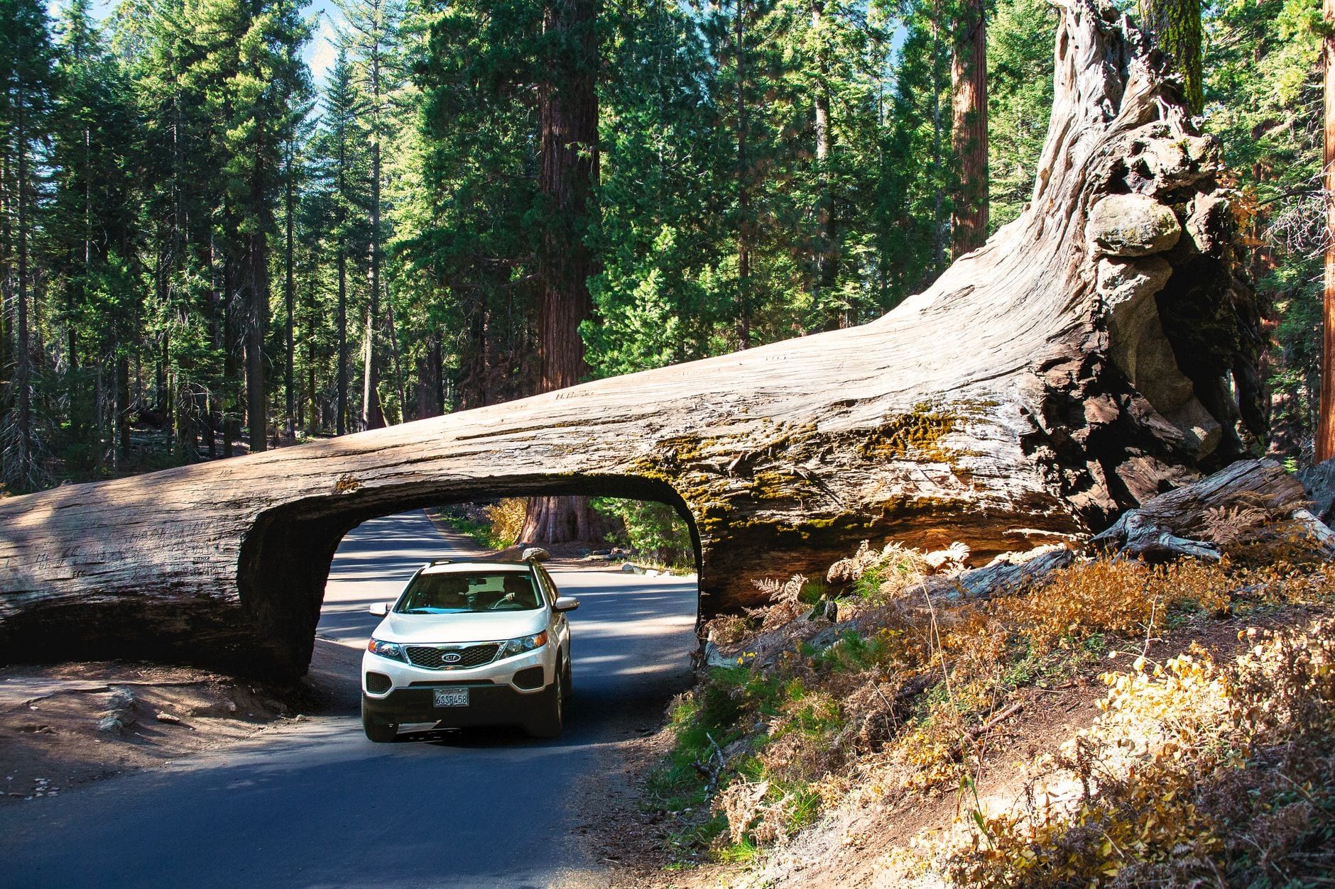
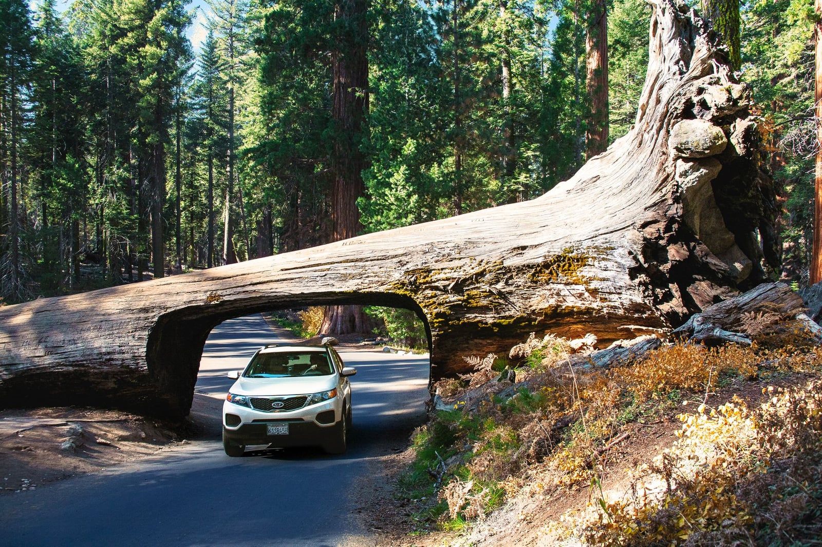
Tunnel Log is the classic photo stop on the way down from Moro Rock: a giant sequoia that fell across the road in 1937, with a car-sized tunnel cut through its trunk the following year. You can drive through it — most vehicles fit — in about ten seconds flat. It's a quick stop, and the Crescent Meadow trailhead, John Muir's "Gem of the Sierra," is just beyond it.
One last habit for the drive home: check your fuel before you leave the Giant Forest. It's an hour back down to Three Rivers and 45 minutes to Visalia, and the tank you topped off two days ago has been quietly feeding those switchbacks the whole time.
Frequently asked questions
How far is Sequoia National Park from San Francisco?
About 280 miles and 5-6 hours to Sequoia's Ash Mountain entrance via CA-99 and CA-198 in normal traffic. The NPS lists 250 miles and about 4 hours 30 minutes to Kings Canyon's Big Stump entrance via CA-180 — the shorter drive on paper. Visalia, the last major city, is 36 miles and 45 minutes from Ash Mountain.
Can you do a day trip from San Francisco to Sequoia National Park?
Technically yes, but it means 10-12 hours of round-trip driving for a few hours in the park. It's only realistic in summer with a pre-dawn start and a short sight list, and winter makes it riskier still. Book at least one overnight; 2-3 days is the sweet spot.
Which route should I take — CA-198 or CA-180?
CA-99 south to CA-198 east through Visalia is the standard route to Sequoia's Ash Mountain entrance and the Giant Forest. CA-180 through Fresno is the NPS-preferred route for longer vehicles — straighter, wider, less steep — and leads to Kings Canyon's Big Stump entrance and Grant Grove. The roads connect inside the parks, so you can enter one way and exit the other.
Do I need snow chains to drive to Sequoia in winter?
Yes — chains may be required on park roads any time it snows, typically late fall through spring. They're sold or rented near the entrance stations, but rent ahead on storm days. Storms can close the Generals Highway between Hospital Rock and the Giant Forest, so call the road-conditions line at (559) 565-3341 before you drive.
Is there gas inside Sequoia National Park?
No. There are no gas stations or EV chargers within park boundaries — only a limited seasonal station at Stony Creek Village between the two parks. Fill up in Visalia or Fresno, or use the stations in Three Rivers or Dunlap closest to the entrances.
How much does it cost to get into Sequoia National Park?
$35 per private vehicle, valid 1-7 days and covering both Sequoia and Kings Canyon plus the Hume Lake District of Sequoia National Forest. Entrance stations are cashless — credit, debit or mobile payment only. The $80 America the Beautiful annual pass is the better deal if you'll visit other national parks within a year.
How do I get to Sequoia from San Francisco without a car?
Take Amtrak's San Joaquins to Hanford (then a connecting bus) or Greyhound to Visalia, and finish on the Sequoia Shuttle — about 10.5-11 hours total for $29-50 plus roughly $20 for the shuttle round trip. The shuttle runs summer only, and rideshare for the mountain leg is expensive and unreliable, so renting a car is almost always the better choice.
Where should I stay when driving from San Francisco to Sequoia?
Three Rivers is closest to the Ash Mountain entrance (about 15 minutes) at gateway-town prices; Visalia is budget-friendlier with full services but a 45-minute commute. In the park, Wuksachi Lodge is the main hotel, Potwisha Campground is open year-round, and Lodgepole runs late April through November — reserve campsites on recreation.gov and book summer lodging months ahead.