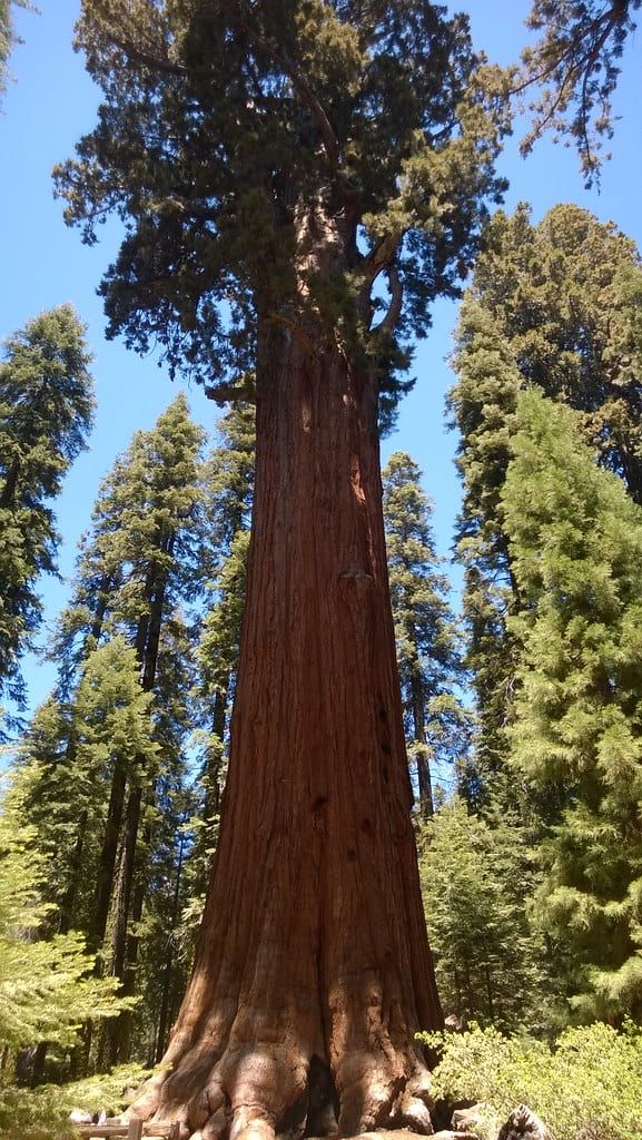
Most of what people picture when they think of Sequoia — General Sherman, the Congress Trail, Moro Rock at sunset — fits into one long, well-timed day. The mistake first-timers make is treating the park like a drive-through. It's a winding, climbing 45 minutes from the Ash Mountain entrance to the Giant Forest, and parking, not distance, is what eats your schedule.
This itinerary anchors everything in the Giant Forest, the largest unlogged sequoia grove on Earth, and builds outward. One day covers the essentials. A second adds the park's best waterfall hike and Crystal Cave. A third adds Kings Canyon, whose General Grant Tree and Cedar Grove valley sit about an hour up the Generals Highway — and your $35 pass already covers both parks.
Sequoia National Park Itinerary at a Glance: 1, 2 or 3 Days
So how many days should you book? One day, started at 7am, gets you every headline sight: the world's largest tree, a quiet loop through the grove it lives in, a flat meadow walk, the Tunnel Log photo, and a granite-dome sunset. Two days is what I'd recommend for most first visits — the second day buys you Tokopah Falls and Crystal Cave, the two things a one-day schedule forces you to skip. A third day belongs to Kings Canyon, which shares your entrance pass and is connected by the same road but draws a fraction of the crowds.
| Days | The plan |
|---|---|
| 1 day | General Sherman, Congress Trail, Big Trees Trail, Giant Forest Museum, Crescent Meadow, Tunnel Log, Moro Rock sunset |
| 2 days | All of the above, plus Tokopah Falls (4.1 mi RT) and a Crystal Cave tour |
| 3 days | All of the above, plus Kings Canyon: General Grant Tree, Cedar Grove, Mist Falls or Zumwalt Meadow |
Enter at Ash Mountain, off Highway 198 through Three Rivers, for the one-day plan — it puts you closest to the Giant Forest climb. Coming from Fresno, or driving anything over 22 feet? Use the Big Stump entrance on Highway 180 instead; the 198 side is tight, twisting, and hard on bigger vehicles. Best months are June through October for full road access, with May and late September the picks if you'd rather dodge crowds than have every road open. The whole strategy fits in one sentence: park at the Giant Forest Museum, ride the free shuttle, and save the two drive-only stops for late afternoon.
Know Before You Go: Fees, Entrances and Park Logistics
Four or five logistics details decide whether a Sequoia day runs smoothly or falls apart at 10am in a entrance line. Here they are in one place: which gate, what it costs, how to get there, and the on-the-ground realities — no gas, no cell service, altitude, bears — that shape the plan.
Entrances and lines
The park has two entrances, both on the west side — there is no eastern entrance, despite what some maps imply. Ash Mountain (Highway 198, via Three Rivers) is the classic Sequoia gate and the one this itinerary assumes. It backs up badly: on summer weekends and holidays, expect waits of an hour or more between 9am and 1pm. Get there by 8am or after 3pm. Big Stump (Highway 180, via Fresno) rarely has a line and is the saner approach for RVs and for anyone coming from the north.
Fees and passes
A private vehicle costs $35, valid 1-7 days and covering everyone in the car plus Kings Canyon and the Hume Lake district of the national forest. Walk-ins and cyclists 16 and over pay $20 per person. Entrances take card and mobile payment only — no cash at the booths — so buy your pass online beforehand or carry plastic. One wrinkle most guides miss: non-US residents 16 and older pay an additional $100 per person on top of the vehicle fee unless they hold an America the Beautiful ($80) or park annual pass. Full hours and entry fee details are worth a look before you go, since visitor center hours shift with the seasons.
Getting there
Fresno Yosemite International (FAT) is the closest major airport, about an hour and 45 minutes from the Ash Mountain entrance. Los Angeles is 225 miles and roughly four hours away; if that's your starting point, our drive from Los Angeles guide breaks down routes and stops. San Francisco is about 4.5 hours. One GPS tip that saves people real confusion: navigate to the Foothills Visitor Center, not "Sequoia National Park," which some apps route to odd trailheads. Car-free in summer? The Sequoia Shuttle from Visalia runs about $20 round trip from late May to early September.
The realities that shape your day
There is no gas inside the park except seasonally at Stony Creek Village, between the two parks — fill up in Three Rivers or Dunlap. Cell service is essentially gone once you climb past the foothills, so download offline maps at your hotel. The Giant Forest sits near 7,000 feet; pace yourself on the first climbs and drink more water than feels necessary. Black bears are active — every scrap of food and anything scented goes in the bear boxes at trailhead lots, and fines follow sloppy storage. Dogs aren't allowed on any trail, leashed or not.
Getting Around: Parking and the Free Sequoia Shuttle
Parking is the single biggest threat to a Sequoia itinerary, and the free shuttle is the fix. From late May through early September, and on holiday periods, the park runs fare-free buses through the Giant Forest and Lodgepole areas on color-coded routes: one loops the Giant Forest core, another branches out to Crescent Meadow, Tunnel Log and Moro Rock, and a third serves the General Sherman Tree and Wolverton. Buses run roughly 8am to 6pm, no reservations needed, and they're wheelchair accessible.
The play is simple: park once at the Giant Forest Museum lot (or Lodgepole if that's full) and shuttle between stops. The Sherman Tree lot is the one that hurts — it fills by about 9am on summer days, which is exactly why the itinerary below puts you there at 8. One rule reshapes the afternoon: on weekends and holidays while the shuttle runs, Crescent Meadow Road is closed to private vehicles. Private cars get it back in the evening. That's not a bug in this plan — it's the reason Tunnel Log and Moro Rock are evening stops. Kings Canyon has no shuttle of its own, so there you drive everything.
The Perfect One-Day Sequoia National Park Itinerary (Hour by Hour)
This schedule assumes a summer or early-fall day, an Ash Mountain entry, and legs that can handle a couple of short climbs. Times are loose on purpose — but the 8am Sherman arrival and the evening Moro Rock finish are the two anchors you shouldn't move.
Drive up from Three Rivers the night before if you can. Waking up 15 minutes from the gate instead of 90 is the difference between a relaxed day and a race.
7:00 AM — Enter at Ash Mountain and climb Generals Highway
Beat the 9am line by entering between 7:00 and 7:30. The climb from the foothills to the Giant Forest takes about 45 minutes on the Generals Highway — narrow, curvy, with blind corners and real drop-offs, so let faster cars pass. Two quick stops break it up: Tunnel Rock, where the old road literally passed through a boulder, and Amphitheater Point, a pullout with the first big view back over the canyon you just climbed out of. Keep both under ten minutes. The trees are the point.
8:00 AM — General Sherman Tree
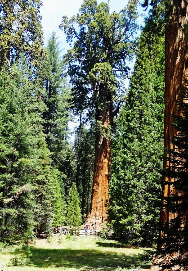
The main trail drops half a mile, paved, from the parking area off Wolverton Road, with some stairs and an uphill walk back — budget the return when you're timing the morning. At the bottom stands the largest tree on Earth by volume: 52,508 cubic feet of trunk, 274.9 feet tall, somewhere past 2,000 years old. Numbers don't really do it. You'll know what people mean when they say the trail feels like a cathedral. There's also a short, fully accessible 500-foot path from a disability-placard lot along the Generals Highway if stairs are a problem. Either way, arriving at 8 means sharing the tree with dozens instead of hundreds.
9:30 AM — Congress Trail
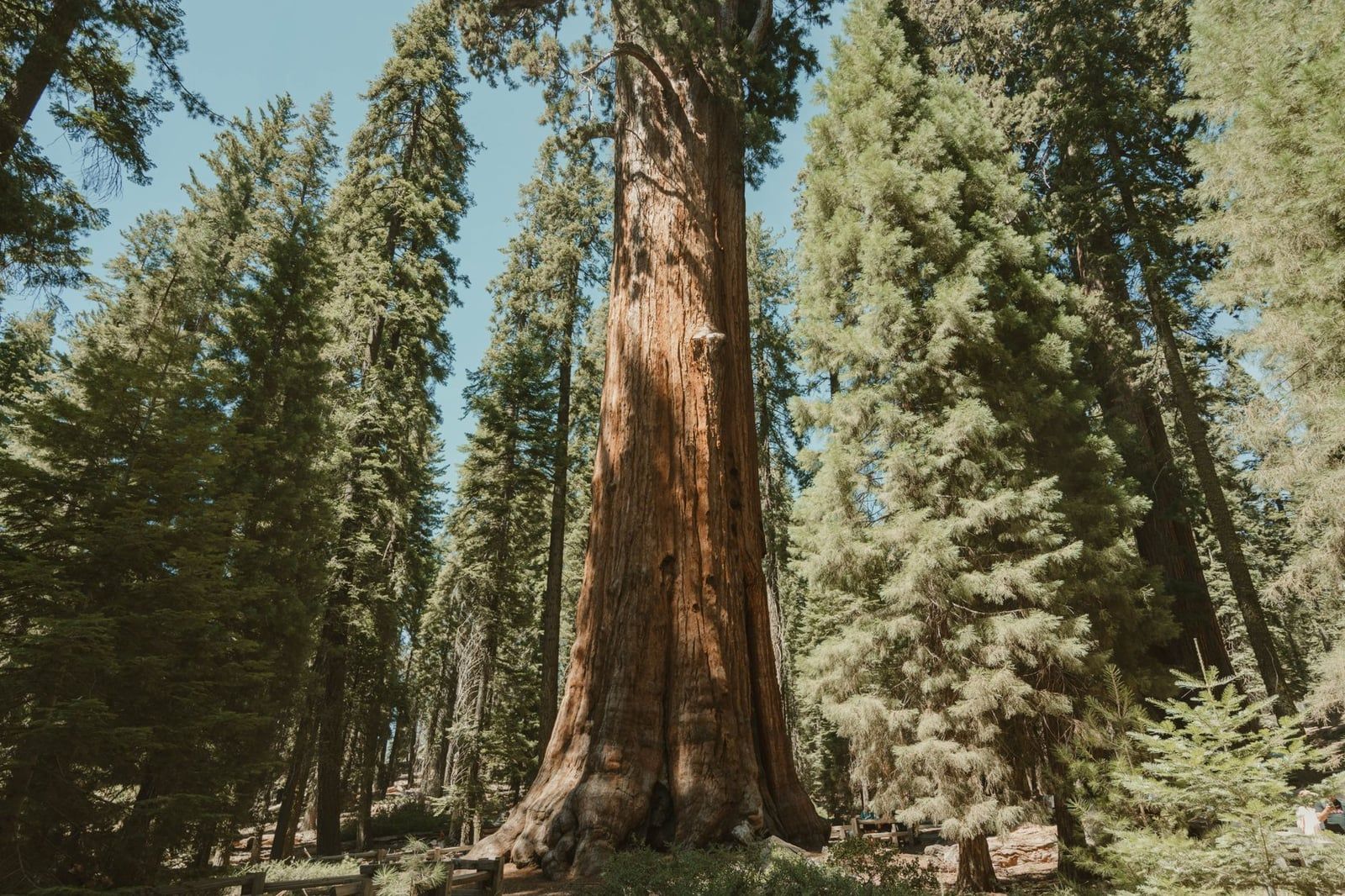
From Sherman, continue onto the Congress Trail, a roughly 2-mile paved loop through the quietest big trees in the park. This is where the grove stops being an attraction and starts being a forest — the President Tree, the House and Senate groups, Chief Sequoyah, all standing off a trail that's usually near-empty an hour after Sherman's crowd turns around. Walk it clockwise or counterclockwise; it doesn't matter. You'll exit near where you started, ready for the drive or shuttle to Lodgepole.
11:00 AM — Lunch and Big Trees Trail at Lodgepole
Lodgepole is the park's practical hub: a market and grill for lunch, restrooms, and a visitor center. Grab food, then either picnic or eat at the grill and save your sandwich. Afterward, drive or shuttle to the Giant Forest Museum and walk the Big Trees Trail — a 1.2-mile flat, paved loop around Round Meadow that's as close to effort-free as sequoia viewing gets. The museum itself takes 20 minutes and is worth every one: it explains why these groves survived the loggers and how fire, counterintuitively, keeps them alive. Rangers at the desk will also tell you the day's parking and road status, which you'll want for the afternoon.
1:30 PM — Crescent Meadow and Tharp's Log
John Muir called Crescent Meadow the "Gem of the Sierra," and on an early-summer day, ringed with wildflowers and standing sequoias, it earns the name. The loop around it, extended to Tharp's Log, runs about 1.9 miles — mostly flat. Tharp's Log is the oddball highlight: a cabin built in 1861 inside a hollowed fallen sequoia, one of the first homes in the area, still holding its shape. On a summer weekday you can drive here; on a weekend, the shuttle is your only midday option, so check the status you got at the museum and time this stop to match. Tired legs can shorten it to the meadow loop alone and lose little.
4:00 PM — Tunnel Log
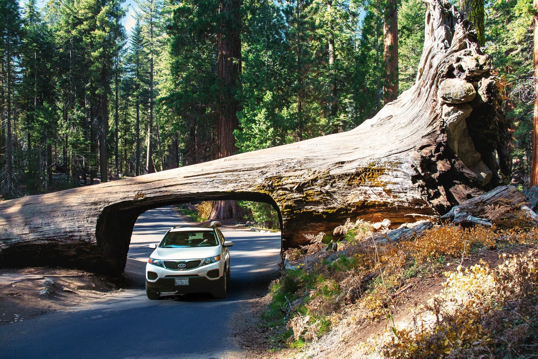
Drive back onto Crescent Meadow Road in the late afternoon, once private cars are allowed again on weekends, and stop at the Tunnel Log — a giant sequoia that fell in 1937 and had a car-sized tunnel cut through its trunk the next year. Cars under about 8 feet can drive through it; everyone else walks. It's a five-minute stop, pure photo op, and it puts you exactly where you need to be for the finale.
5:30 PM to sunset — Moro Rock
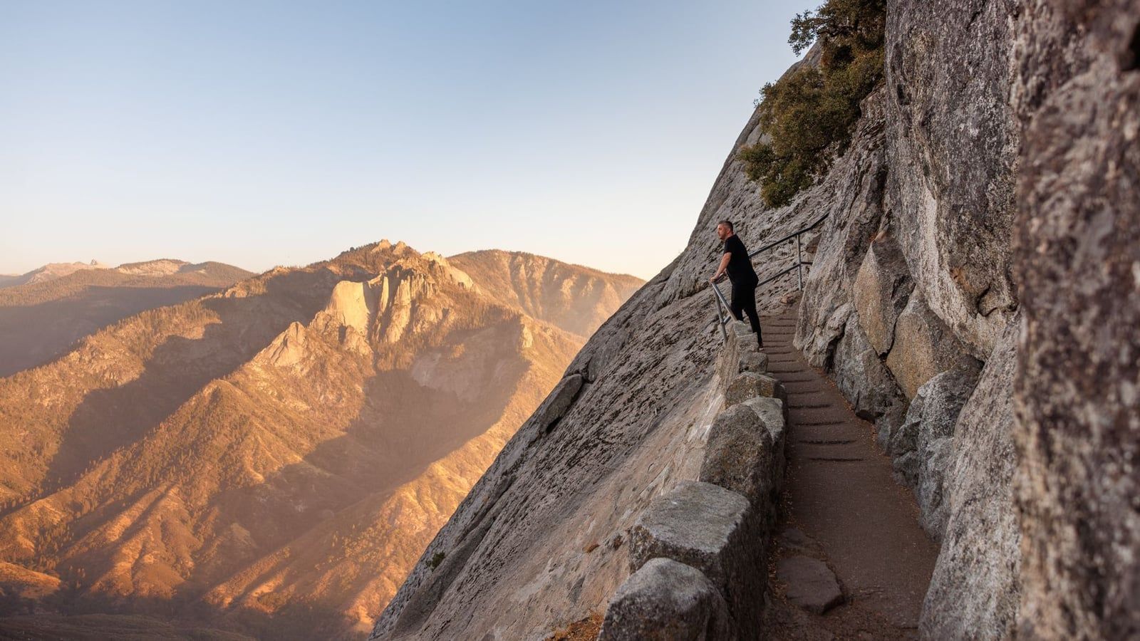
Moro Rock Road climbs from the Tunnel Log to a parking area at the base of a 6,725-foot granite dome. From there it's half a mile and about 400 stone steps, hand-railed and carved into the rock, to the top — short but steep, and rated moderate for a reason. The payoff is a full circle: west over the haze of the Central Valley, east to the sawteeth of the Great Western Divide. Sunset is prime time, when the light goes orange on the peaks and the day crowds have gone. Bring a headlamp; the steps are no place to feel for footing in the dark. Then it's a 45-minute descent back to Three Rivers, or ten minutes to Wuksachi if you're staying in the park.
Day 2: Tokopah Falls, Crystal Cave and Quieter Sequoia
A second day swaps the checklist for the stuff there wasn't time for — and the top of that list is where the regrets live. Book Crystal Cave before your trip; the trail and the falls you can decide on the morning of.
Tokopah Falls
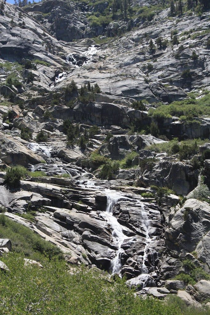
Start at Lodgepole and follow the Marble Fork of the Kaweah River upstream. It's 4.1 miles round trip with about 626 feet of gain — moderate, mostly gentle, dramatic at the end, where the valley's headwall rises around a 1,200-foot waterfall. Timing matters more than fitness: the falls thunder from May through early July and dwindle to a trickle by late summer. Go in June if you have the choice. Our rundown of the best hikes in Sequoia places it near the top for good reason.
Crystal Cave
This marble cavern is the one thing on Day 2 that requires advance planning: tours run about 50 minutes, cost roughly $24 per adult, and must be booked online ahead of time — no tickets are sold at the cave. The season runs from late May to November 1, and the cave reopened in 2025 after an extended closure, so demand is high; book the moment your dates are fixed. Budget the drive: it's about 45 minutes from the Giant Forest Museum down a road closed to vehicles over 22 feet combined length, plus a steep half-mile walk down to the entrance. Inside it's a constant 48°F — bring a layer, even in July. Our Crystal Cave guide covers tickets, tour types and what the walk down is really like.
Little Baldy at sunset
If you'd rather not repeat Moro Rock, Little Baldy is the locals' sunset: a 3.3-mile round trip with about 800 feet of gain to a bare granite summit with 360-degree views and a tenth of the crowd. The trailhead is right off the Generals Highway. Legs done after the morning? A second, slower pass on the Congress Trail or the Big Trees loop is a perfectly good evening — the light through the grove late in the day is the best of it.
Day 3: Adding Kings Canyon National Park
Same pass, same road, different park — and a fraction of Sequoia's traffic. If you're weighing how the two compare, our Kings Canyon vs Sequoia breakdown helps; the short version is that Kings Canyon is deeper, quieter, and greener, with one of the world's biggest trees as its front door.
Morning: General Grant Tree
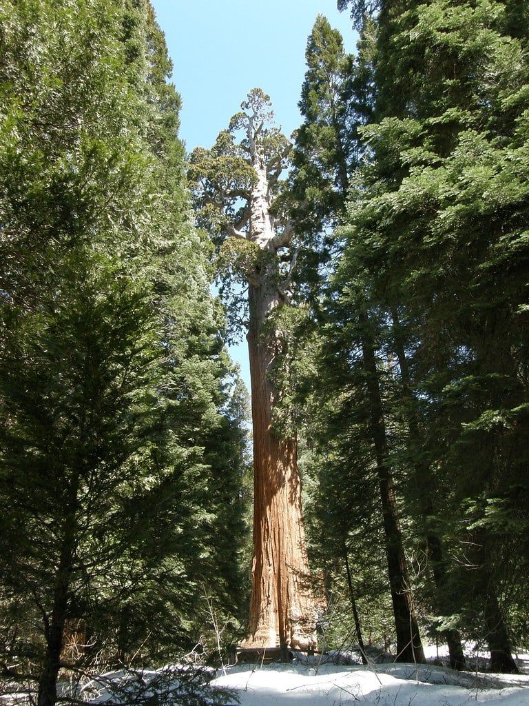
Start at Grant Grove, about an hour's drive from the Giant Forest. The General Grant Tree is the second-largest tree on Earth and is designated the Nation's Christmas Tree; the paved loop past it runs just 0.7 miles and takes under an hour. Go early — this is Kings Canyon's most popular stop, and the lot fills by mid-morning in summer. If you have spare minutes, the Big Stump Trail nearby walks through the remains of the grove's logging era, a stark contrast to the uncut forest you've been walking for two days.
Afternoon: Kings Canyon Scenic Byway to Cedar Grove
The byway drops from Grant Grove into one of the deepest canyons in the United States — a drive of roughly an hour to 90 minutes each way. It's seasonal, typically open May into early November, and checking its status the night before is non-negotiable; a closed road turns this day into a Grant Grove morning and a long afternoon. Once down in Cedar Grove, pick your anchor by legs. Hikers: Mist Falls, an 8-mile round trip with about 900 feet of gain from Road's End, ending at a powerful waterfall on the South Fork Kings River. Everyone else: the 1.5-mile Zumwalt Meadow loop, flat and lush beneath sheer granite walls. Both crowds can tack on Roaring River Falls, a 0.3-mile paved path to a chute of water squeezed between rock.
For the night, John Muir Lodge and the Grant Grove Cabins sit right at Grant Grove; staying there saves you the climb back out of the canyon twice. Driving back toward Sequoia or Three Rivers instead adds an hour-plus but keeps you positioned for the Ash Mountain exit the next morning.
Where to Stay and Eat Along the Plan
Lodging is a timing decision in Sequoia, not just a comfort one. Staying close is what buys you the 7am start, and the in-park dining is thin enough that it's worth knowing exactly where your next meal is coming from.
Where to sleep
Wuksachi Lodge is the only lodge inside Sequoia, minutes from the Giant Forest trailheads — and it prices and books accordingly, with summer rooms from around $300 a night and roughly six months of lead time. If the 7am entrance start matters to you, this is the lodging that buys it. Three Rivers, about 15 minutes from the Ash Mountain gate (but 45 from the Giant Forest itself), is the practical base for one-day and early-start trips — AutoCamp's stylish cabins and a run of motels cover most budgets. Visalia is a real city 45 minutes from the entrance, but basing there adds 1.5 to 2 hours of daily driving; Tulare is the budget fallback. Campers: Lodgepole and Dorst Creek put you closest to the Giant Forest, while lower, warmer Potwisha suits the cooler months.
Where to eat
In-park dining is thin, so plan around it rather than being surprised by it. Lodgepole's market and grill handle lunches and camp food. Dinner at Wuksachi's Peaks Restaurant runs $30-50 a person — make a reservation — and the Pizza Deck near the Giant Forest covers the casual end. There's little else between them, so on hiking days pack a picnic from Three Rivers or Visalia and treat lunch as a trailhead affair.
How the Itinerary Changes by Season
June through October is the full-access window: every road, every shuttle, every cave tour. May and late September are the trade-off months — thinner crowds, pleasant foothill temperatures, but some high roads still shut. Late spring can even drop a surprise snowstorm, and rivers run fast, cold and genuinely dangerous with snowmelt, so keep kids out of them. Our season-by-season guide goes deeper on weather, crowds and prices.
The one closure that reshapes a one-day plan is Crescent Meadow Road, which can stay closed into late May. If it's shut, pivot the day to Sherman, Congress and Big Trees, and hike — don't drive — out to Moro Rock, or settle for the views at Amphitheater Point instead. Winter is a different trip entirely: the Giant Forest stays reachable, chains may be required at any time, and Crescent Meadow Road, the Moro Rock road and Mineral King Road all close to vehicles, though the first two stay open for snowshoeing. Tokopah Falls and Crystal Cave are off the table. What's left — Sherman in the snow, an empty Congress Trail, cross-country tracks around Crescent Meadow — is arguably the park at its best; our Sequoia in winter guide has the details.
| If this is closed | Swap in |
|---|---|
| Crescent Meadow Road (spring) | Sherman + Congress + Big Trees day; walk to Moro Rock or use Amphitheater Point |
| Moro Rock Road (winter) | Snowshoe in on the closed road; or a second Giant Forest loop |
| Cedar Grove road (roughly Nov-May) | Grant Grove day: General Grant Tree and Big Stump Trail |
| Crystal Cave (Nov-May) | Tokopah Falls plus a slow Congress Trail revisit |
What to Skip on a First Visit
A short trip needs a cut list as much as a plan. These are the ones people regret squeezing in:
- The foothills — scenic, but don't trade Giant Forest time for them.
- Mineral King — a winding, roughly 2-hour drive each way; it needs its own day.
- Crystal Cave on a one-day visit — only if you already hold tickets and will cut a hike.
- Long alpine hikes like Pear Lake, Alta Peak or Mist Falls — full-day commitments.
- Hume Lake and Yosemite detours — save both for a return trip or a separate road-trip day.
Everything else on this itinerary earns its slot. If you have to cut inside the one-day plan, drop Tharp's Log before the Congress Trail, and never drop the 8am Sherman start — that single decision is what makes the rest of the day work.
Frequently asked questions
Is one day enough for Sequoia National Park?
Yes, for the essentials: General Sherman, the Congress Trail, Big Trees Trail, Crescent Meadow, Tunnel Log and a Moro Rock sunset all fit in one day if you enter by 8am. A second day adds Tokopah Falls and Crystal Cave; a third adds Kings Canyon.
Do I need a reservation or timed entry to visit Sequoia National Park?
No timed-entry reservation is required — you just pay the $35 per vehicle fee, by card or mobile payment only at the stations. Two things do need advance booking: Crystal Cave tours (online only, about $24 per adult) and Wuksachi Lodge rooms, which sell out roughly six months ahead in summer.
Which entrance should I use — Ash Mountain or Big Stump?
Ash Mountain (Highway 198 via Three Rivers) is the main Sequoia entrance but can back up over an hour on summer weekends between 9am and 1pm; arrive by 8am or after 3pm. Big Stump (Highway 180 via Fresno) rarely has a line and is the easier drive, especially for longer vehicles.
How hard is the Moro Rock hike?
Short but steep: about half a mile and roughly 400 stone steps up a granite dome, rated moderate. The reward is a 360-degree view west to the Central Valley and east to the Great Western Divide. Sunset is the best time — bring a headlamp for the way down.
Can you visit Sequoia National Park in winter?
Yes. The Giant Forest stays accessible much of the year, but Crescent Meadow Road and Moro Rock Road close to vehicles (snowshoeing is still allowed), tire chains may be required, and Tokopah Falls and Crystal Cave are out. Plan a Giant Forest-focused day: Sherman, the Congress Trail and Big Trees Trail.
Do I need to take the shuttle, or can I drive between stops?
You can drive, but the Sherman Tree lot fills by about 9am in summer. The smarter play is parking once at the Giant Forest Museum and using the free shuttle. On summer weekends and holidays, Crescent Meadow Road closes to private cars during shuttle hours, which makes Tunnel Log and Moro Rock evening drive stops.
Are Sequoia National Park and Redwood National Park the same thing?
No. Sequoia, in the southern Sierra Nevada, protects giant sequoias — the largest trees on Earth by volume, like the 274.9-foot General Sherman. Redwood National Park, on the northern California coast more than 500 miles away, protects coast redwoods, the tallest trees. Different parks, different trees.
Where should I stay for an early start — inside the park or in Three Rivers?
Both work. Wuksachi Lodge (from about $300 a night in summer, booked roughly six months out) puts you minutes from the trailheads, while Three Rivers is 15 minutes from the Ash Mountain gate and far cheaper. Avoid Visalia for early starts — it adds 1.5 to 2 hours of driving round trip.