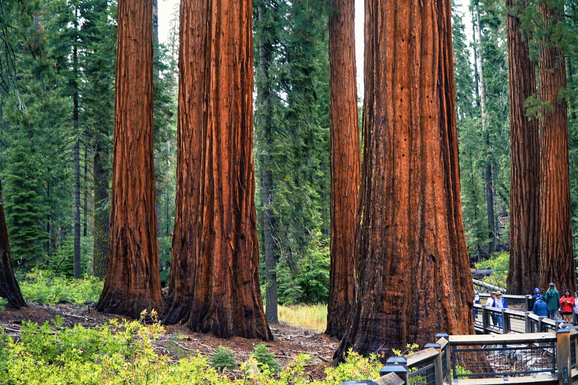
Sequoia National Park climbs from 1,370 feet of oak foothills to the 14,494-foot summit of Mount Whitney, but almost every first visit plays out in one place: the Giant Forest, the largest unlogged sequoia grove on Earth and home to the largest tree on Earth. You can see the park's highlights in a single, well-timed day. Hikers and cave-goers will want two or three.
This guide ranks what's actually worth your time, then adds the details that decide whether each stop works on your trip: how long it takes, how hard it is, when it's open, and how to string the stops together without sitting in traffic.
Quick Answer: The Best Things to Do in Sequoia at a Glance
The table below covers the six stops that anchor most visits, ranked by payoff per hour rather than by location. The rest of this guide fills out the long list — Giant Forest Museum, Crescent Meadow, Hospital Rock, the waterfalls, Mineral King, and the backcountry — with the timing and booking details you'll need.
| Activity | Park area | Time needed | Effort | Best season |
|---|---|---|---|---|
| General Sherman Tree | Giant Forest | 1 hour | Easy | Year-round |
| Congress Trail | Giant Forest | 1–1.5 hours | Easy | Year-round |
| Moro Rock | Crescent Meadow Rd | 1 hour | Moderate | Late spring–fall |
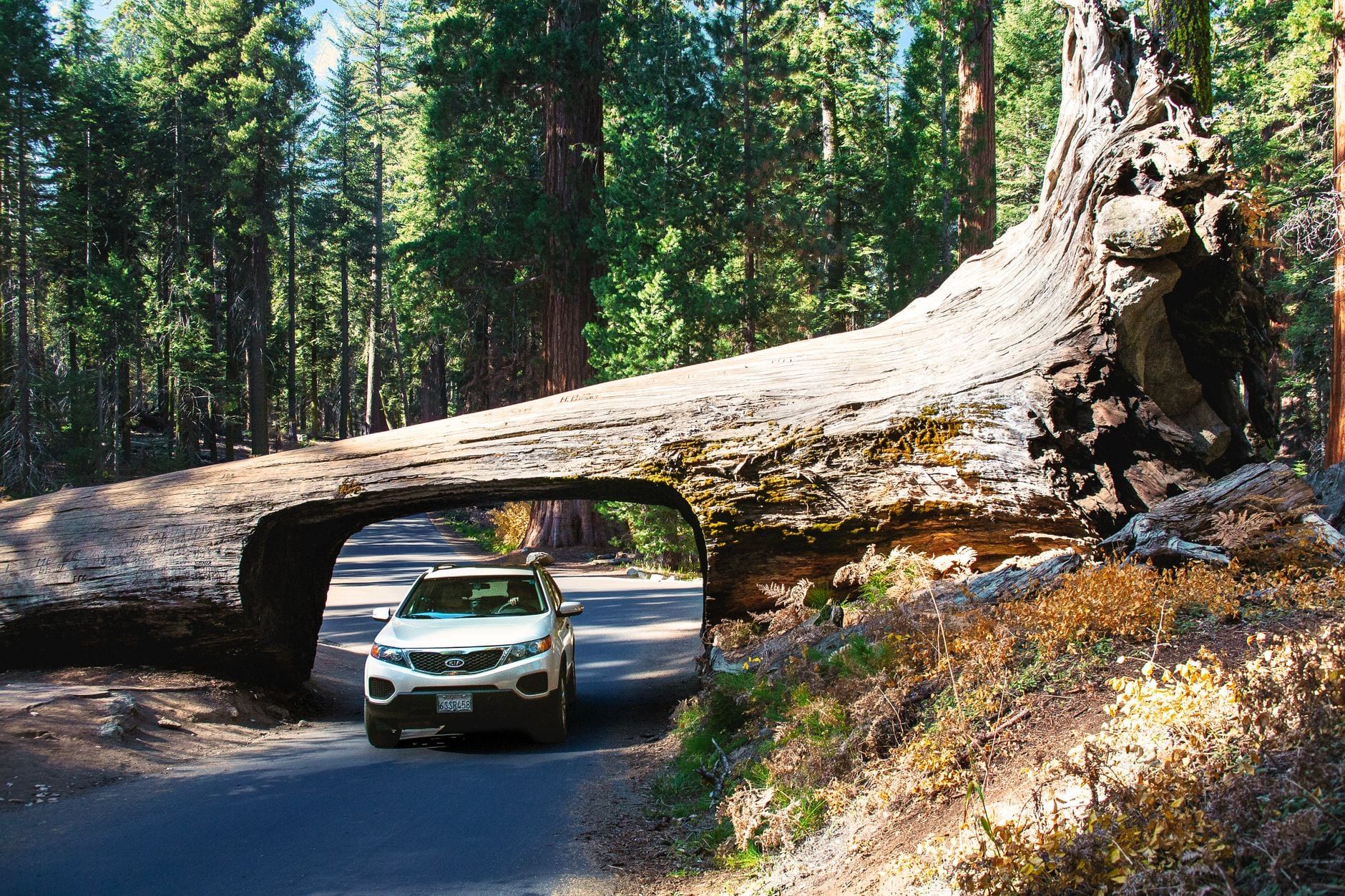
| Tunnel Log | Crescent Meadow Rd | 10 minutes | Easy | Late spring–fall |
| Crystal Cave | Marble Fork | Half a day | Moderate | Late spring–early fall |
| Tokopah Falls | Lodgepole | 3–4 hours | Moderate | Spring–summer |
First-timers can knock out the major sights in one full day, but hikers get the most variety from about three. Either way, the sequencing matters more than the list — the park's parking lots fill by late morning in summer, which is why the day plan later in this guide starts with an 8 am entrance. Everything in the table sits in or near the Giant Forest, the grove that justified the park's creation in 1890: America's second national park, and the first created to protect a living organism. Plan the cluster as one outing — park once, then walk or shuttle between stops.
General Sherman Tree & the Congress Trail: The Giant Forest Core
The park's five biggest draws sit within a couple of miles of each other up here. Do this cluster as a single morning and you'll have seen the essence of Sequoia before lunch.
General Sherman Tree
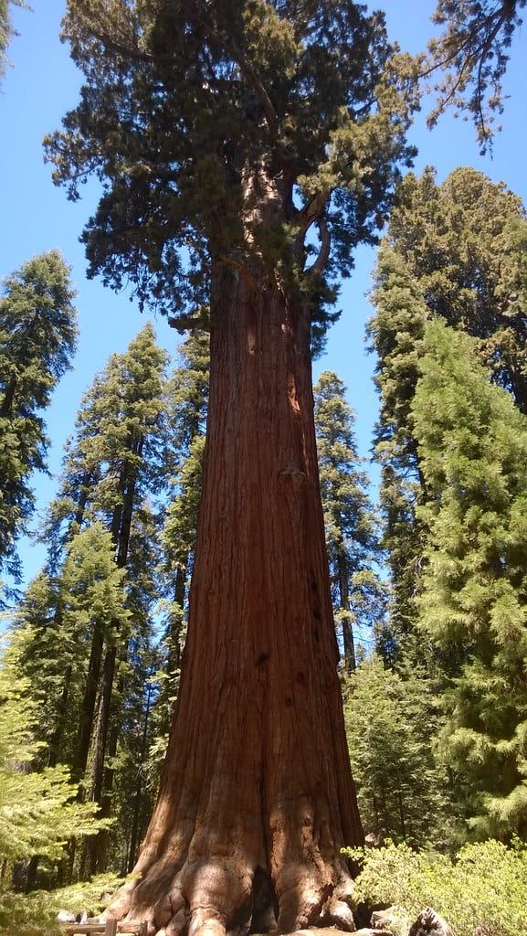
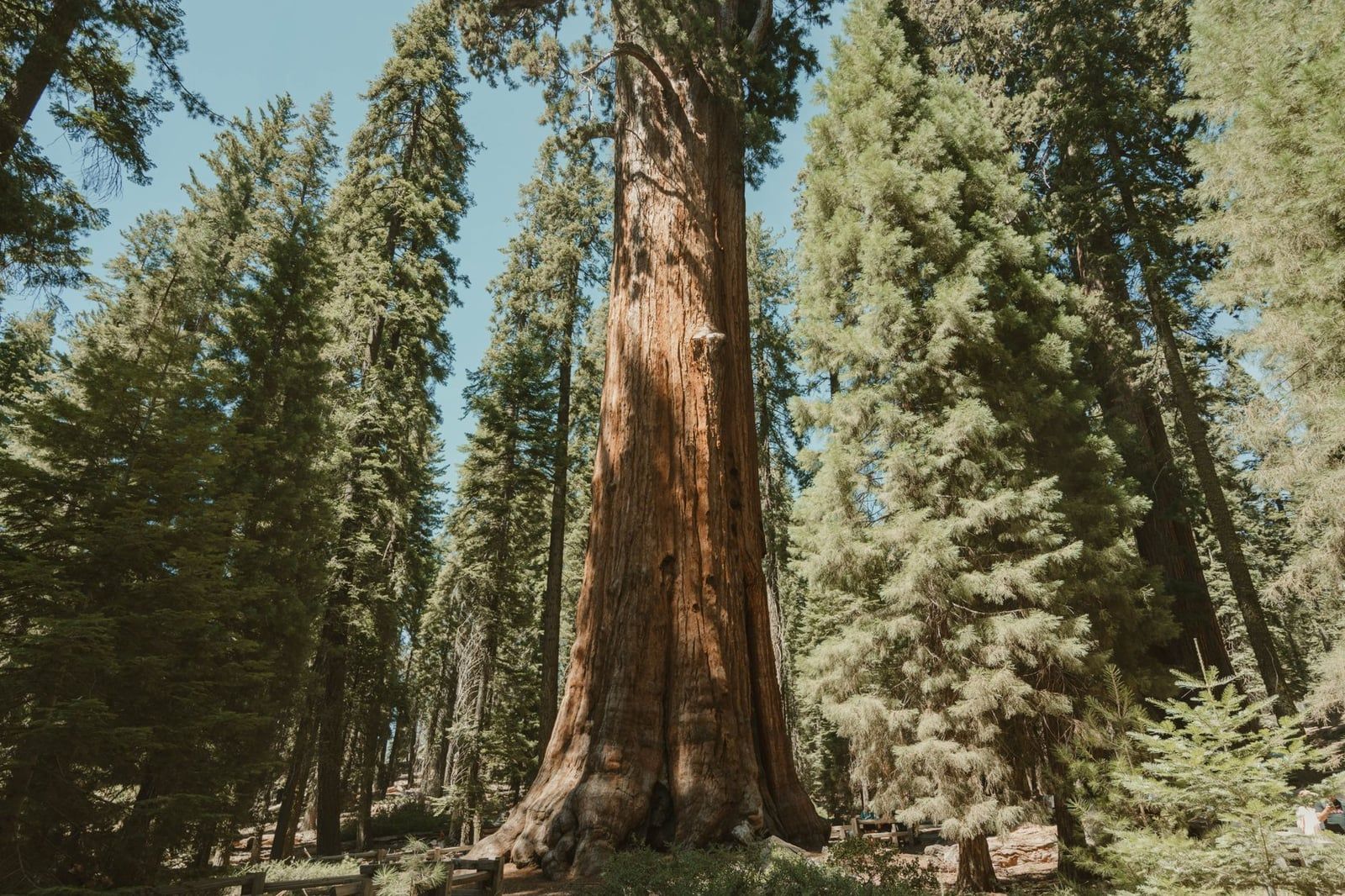
The largest tree on Earth by volume: 52,508 cubic feet of trunk, 274.9 feet tall, and over 2,000 years old. The main trail is a paved half mile down from the lot off Wolverton Road, and the climb back up is real but short. A separate 500-foot wheelchair-accessible path runs from a disability-placard lot along the Generals Highway to the tree and other named sequoias.
Go early. Giant Forest lots fill in the morning in summer, and the Sherman crowd peaks midday. If you reach the Ash Mountain entrance by 8 am, you'll usually walk straight to the tree with room to breathe.
The Congress Trail
Most visitors photograph Sherman and leave. Don't. The Congress Trail, a paved loop of roughly two miles starting at the tree, passes the President Tree and the clusters named the Senate and the House, plus the Room Tree, a hollow giant you can step inside. Count on 60 to 90 minutes. Crowds thin dramatically after the first quarter mile, and this is the best grove walk in the park.
Big Trees Trail
If you're traveling with a stroller, a wheelchair, or tired legs, the Big Trees Trail is the easier grove option: a flat, 0.7-mile boardwalk loop around Round Meadow with interpretive signs. Free manual wheelchairs can be borrowed at the Giant Forest Museum next door. Twenty minutes of walking, sequoias on every side.
Moro Rock, Tunnel Log, Hanging Rock & Crescent Meadow
Crescent Meadow Road branches off the Generals Highway just past the museum and strings together four stops in about three miles. In summer, take the free shuttle — parking at Moro Rock is scarce and the road has a 22-foot vehicle length limit. The road typically stays closed until late spring while crews clear snow.
Moro Rock
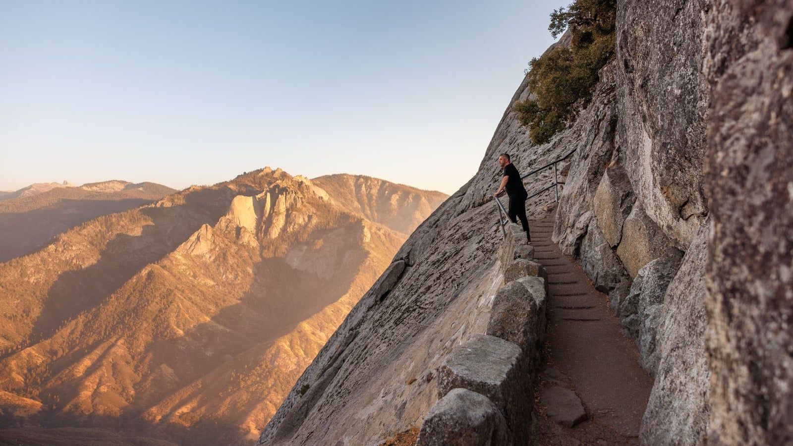
Four hundred concrete steps are carved into this 6,725-foot granite dome, climbing to a panorama across the Great Western Divide and the Kaweah River canyon. Railings line the exposed sections, but there are real drop-offs — if heights trouble you, admire it from below. Sunset from the top is the classic Sequoia evening, when the crowds have gone and the divide turns gold. Give it an hour.
Tunnel Log
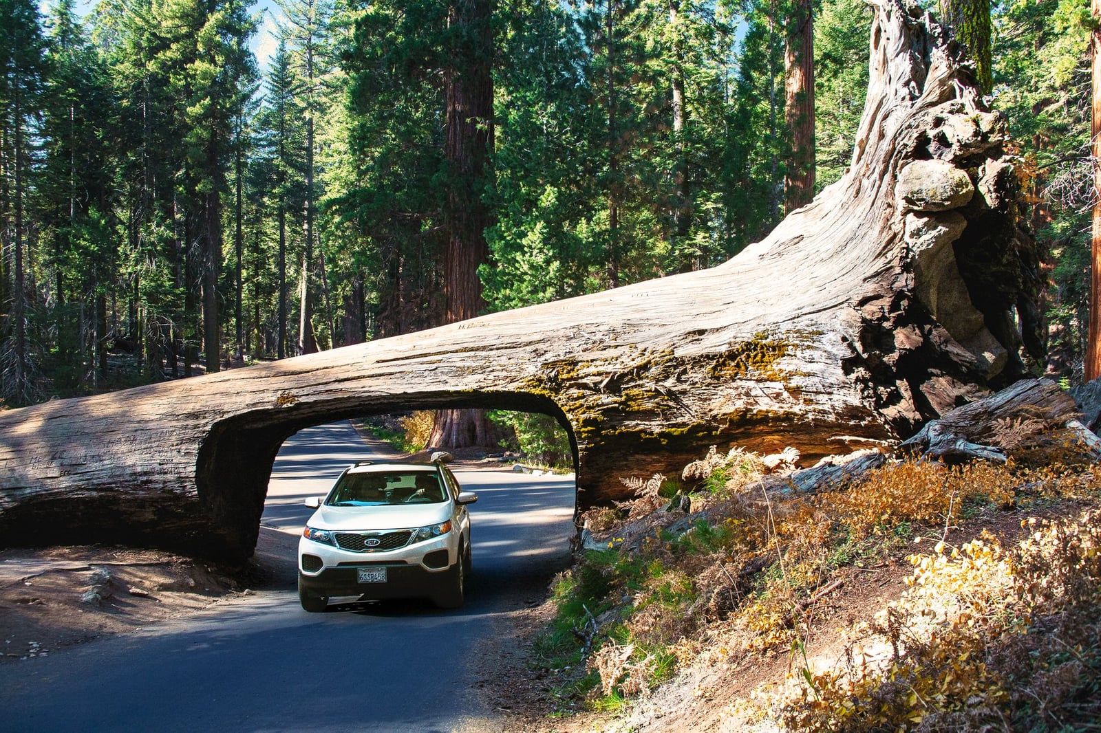
A giant sequoia fell across the road here in 1937, and the next summer crews cut a tunnel through it rather than remove it. The opening is 17 feet wide and 8 feet high; taller vehicles take the bypass lane around it. Ten minutes for the photo — walk through on foot and you'll get a better shot than from the driver's seat.
Hanging Rock
A 0.3-mile round-trip spur from the Crescent Meadow area leads to a granite outcrop hanging over the Kaweah River valley. It's short, quiet, and the view punches well above the effort. Skip it only if you're already running late for Moro Rock.
Crescent Meadow
John Muir called this the "Gem of the Sierra," and the 1.5-mile loop around it explains why: a green clearing ringed by sequoias, wildflowers in early summer, and frequent wildlife in the morning and evening. Partway around stands Tharp's Log, a fallen sequoia that a settler converted into a cabin in the 1860s. There's a picnic area here too.
Giant Forest Museum & the Best Sunset Spots
The free Giant Forest Museum sits where the Generals Highway meets Crescent Meadow Road, and a half hour inside genuinely improves the rest of your visit. The exhibits explain why fire is essential to giant sequoias — their cones need heat to open — and the museum stays open even in winter. Rangers at the desk will tell you current trail and road conditions, which is worth more than any app.
Beetle Rock and Sunset Rock
Both sunset viewpoints start across the road from the museum and face west over the foothills. Beetle Rock is the quick option, Sunset Rock the quieter one.
| Beetle Rock | Sunset Rock | |
|---|---|---|
| Walk from museum | 0.3 mile | 1.6 miles |
| Crowds | Busier — closest parking | Quieter |
| Terrain | Mostly flat | Gentle forest path |
| Best for | A quick stop before dinner | Photographers wanting space |
A good evening runs in that order: museum before it closes around 4:30 pm, dinner at Wuksachi's Peaks Restaurant or the Lodgepole Market and Grill, then back out for stars. On clear summer nights the ranger-led stargazing tours that leave from Wuksachi Lodge cost about $22 and are worth booking.
Crystal Cave: Tours, Tickets & Planning
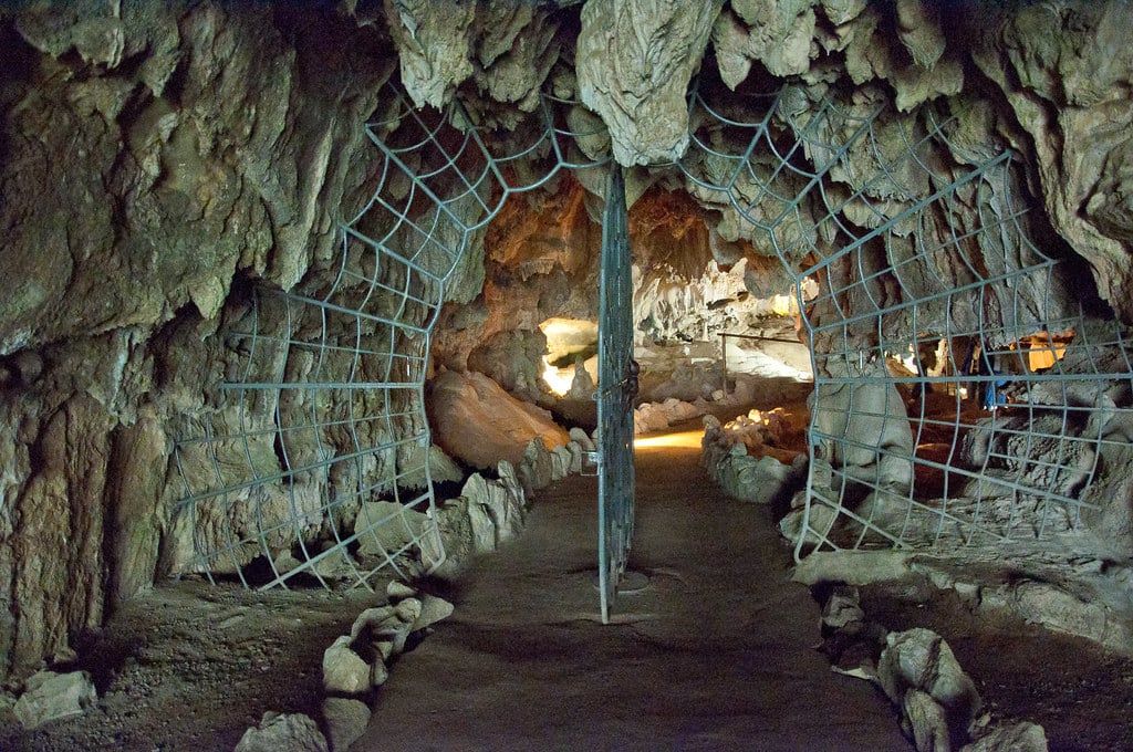
Crystal Cave is the park's only public show cave, a marble cavern of stalactites and stalagmites — and it's the one activity in Sequoia you cannot decide on spontaneously. Visits are guided only, run by the Sequoia Parks Conservancy, and tickets must be bought online at least 36 hours in advance. They are not sold at the cave, and summer dates routinely sell out. Book the moment your dates are fixed; our full Crystal Cave guide walks through the process.
What the visit involves
The tour itself runs about 50 minutes inside the cave, where the temperature holds near 48°F year-round — bring a layer. Getting there is half the effort: a steep half-mile trail descends from the parking area to the entrance, and the road in is a winding, roughly 40-minute drive each way from the main highway. Vehicles over 22 feet combined length, trailers included, are banned from Crystal Cave Road. Tours were suspended after the 2021 wildfires and resumed in May 2025, so the cave is running again — but check the conservancy site for the current season, which generally runs late spring to early fall.
Should you go?
Yes if you have two or more days and you've booked ahead. On a one-day first visit, the drive plus the tour consumes half your daylight, and the Giant Forest deserves it more.
Best Hikes Beyond the Giants: Tokopah Falls, Marble Falls & More
Once you've seen the giants, the trails are the reason to stay another day. Pick by season: the high trails hold snow into early summer, while the low foothills are roasting by July. For a deeper cut, our best hikes in Sequoia roundup has the full list.
Tokopah Falls
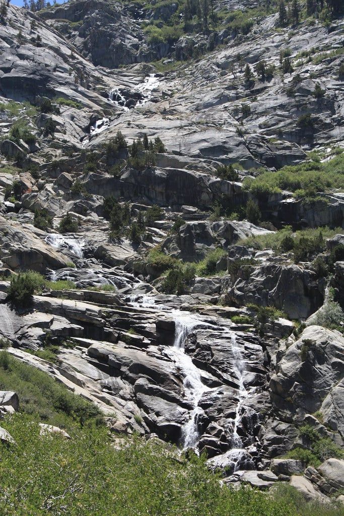
The best waterfall-for-effort in the park. From the trailhead at Lodgepole, the route follows the Marble Fork of the Kaweah River for 1.7 miles to a 1,200-foot cascade pouring down a granite headwall — 3.4 miles round trip, mostly gentle, watchable water the whole way. Go in late spring or early summer when the snowmelt is running hard. Keep children well back from the river; snowmelt currents are fast and cold.
Marble Falls
A 6.3-mile round trip gaining about 1,500 feet in the low Foothills, starting near Potwisha. That low elevation makes it the park's winter and early-spring hike, accessible when the high country is buried. Start early — the foothills bake — and watch for poison oak along the trail.
The Lakes Trail
The serious day hike: 11.2 miles round trip from Wolverton, climbing past Heather and Emerald lakes to Pear Lake below the granite of the Tablelands. It's a full day with real elevation, and one of the few trails here where you can swim in an alpine lake as a reward. Fit hikers only.
Little Baldy
A quieter pick: forest climbing to a granite dome with a 360-degree view and a fraction of the traffic of Moro Rock. Downed trees have made the trail rougher in recent years, so allow extra time and watch your footing.
Beyond the Giant Forest: Generals Highway, Hospital Rock, Mineral King & the Backcountry
The Giant Forest is Sequoia's headline, but the park holds 866 miles of trail, a river canyon, and an alpine valley most visitors never see. Treat this section as second-visit material — or first-visit material if you've got four or more days.
Driving the Generals Highway
The roughly 45-mile Generals Highway connects Sequoia and Kings Canyon, climbing from about 1,400 feet at the Ash Mountain entrance to 7,200 feet at the Giant Forest. The lower switchbacks are tight and twisting with steep drop-offs — drive them slowly. Worth stopping for: Tunnel Rock, a roadside boulder you can pose under, and the Parker Group, a tight cluster of giants right off the road.
Hospital Rock
A roadside stop in the Foothills preserving pictographs and bedrock mortars left by the Potwisha people, who ground acorns in the rocks for centuries. There's a picnic area on the Kaweah River. Twenty minutes, and it's the easiest piece of the park's human history to see.
Mineral King
A high alpine valley at the end of a narrow, winding road that takes about two hours each way from Three Rivers and closes in winter. Go for a full day, not a detour: trails to Franklin Lakes and Monarch Lakes start here, and marmots whistle from the talus. Beautiful, remote, and a poor fit for a first trip on a schedule.
Backcountry and Mount Whitney
Overnight wilderness travel requires a permit — reserve through recreation.gov, or pick up a walk-up permit at a ranger station for $15 plus $5 per person. The High Sierra Trail runs about 70 miles from the Giant Forest across the Sierra to Mount Whitney, the tallest peak in the contiguous United States at 14,494 feet, which sits inside the park's eastern boundary. Summiting Whitney itself requires a lottery permit that's hard to draw. Plan months ahead, not days.
Best Time to Visit, Sample Day Plans & Adding Kings Canyon
Season decides what's open in Sequoia more than in most parks — snow closes whole roads here, not just trails. Below is the access picture, then a plan for each trip length.
When to come
June through September gives full access to roads, trails, shuttles, and Crystal Cave. July and August are the busiest months, and foothill temperatures can hit 105°F — the sequoia groves stay comfortable, but you'll share them. June and September are the smart picks: everything open, fewer people. Winter brings snow, chain requirements, and seasonal closures — Crescent Meadow Road, Mineral King, and the Generals Highway segment between the two parks typically shut from late December through March — though the Giant Forest Museum stays open and families gather at the Wolverton snowplay area. Our Sequoia in winter guide covers that season in detail.
A one-day plan, in order
- 8 am: enter at Ash Mountain; the line exceeds an hour from 9 to 1.
- 8:45: General Sherman Tree, then the Congress Trail loop.
- 11:30: Big Trees Trail boardwalk and Giant Forest Museum.
- 1 pm: picnic at Lodgepole, then catch the shuttle.
- 3 pm: Moro Rock, Tunnel Log, and the Crescent Meadow loop.
- Sunset: Beetle Rock, then dinner at Wuksachi or Lodgepole.
Stretching to two or three days
Day two: Tokopah Falls in the morning, Crystal Cave in the afternoon if you booked it. Hikers should swap in the Lakes Trail instead. A third day goes to Mineral King or a start on the backcountry. Families may prefer to spend day three on picnics, the museum, and river time at Hospital Rock — a slower rhythm that suits the park. For variations, see our detailed Sequoia itinerary.
Adding Kings Canyon
The same $35 pass covers both parks, and they're jointly managed. Kings Canyon holds General Grant, the world's second-largest tree, and Cedar Grove, a glacier-carved valley with granite walls. Driving between the parks' hub areas takes about an hour over 30 winding miles, so base yourself near whichever side you're exploring that day. If you're splitting time, our Kings Canyon vs Sequoia comparison helps you divide the days.
Planning Logistics: Fees, Entrances, Shuttles, Parking & Where to Stay
Everything you need to run the day — fees, fuel, shuttles, beds — in one place. Skim this before you book anything.
Entrances, fees, and timing
Entry costs $35 per private vehicle, valid seven days in both parks; motorcycles pay $30, walkers and cyclists $20 per person. The parks are cashless at entrance stations — bring a card, or buy ahead online. The Ash Mountain entrance on Highway 198, reached via Visalia, is the classic Sequoia route. Vehicles over 22 feet should enter instead at Big Stump on Highway 180 from the Fresno side, which avoids the tightest switchbacks. Arrive by 8 am or after 3 pm to skip the line. Coming from the south, our Los Angeles to Sequoia drive guide covers the roughly four-hour route.
Getting around
There is no gasoline inside either park. Fill up in Three Rivers or Visalia before entering; the only fallbacks are Stony Creek Village seasonally and Hume Lake in the adjoining national forest. From late May to early September, free shuttles loop the Giant Forest and Lodgepole corridor — use them, because parking near Sherman and Moro Rock runs out on summer weekends. There's no public transport between Sequoia and Kings Canyon. Without a car, the paid Sequoia Shuttle connects Visalia to the Giant Forest Museum in summer, about $20 round trip.
Where to stay and eat
Wuksachi Lodge is the only hotel inside the park, around $300 for a double. Campsites at Lodgepole and Potwisha run about $32 a night and need reservations. Outside the gates, Three Rivers motels average $180 and sit about 15 minutes from Ash Mountain; Visalia is roughly 45 minutes out and has the most options. In-park food is limited to the Lodgepole Market and Grill and Peaks Restaurant at Wuksachi — most visitors picnic, and every picnic area has bear-proof lockers, which you're required to use.
Know Before You Go: Bears, Dogs, Weather & Packing
Black bears are common here, and the rules around them carry federal fines. All food and scented items — toiletries included — go in the bear boxes at every parking lot, picnic area, and campsite, never left in a tent or a visible car. Bear spray is prohibited in Sequoia and every other California national park; distance is your defense. Give any bear the space of at least two city buses. If you want to know who else you might see, from marmots to mountain lions, read up on the park's animals before you go.
Dogs are banned from every trail in Sequoia and Kings Canyon. Leashed pets (six feet max) are allowed only on paved roads, in parking areas, picnic areas, and campgrounds, and can't be left in cars. Leave the dog at home or in the motel in Three Rivers.
The elevation swing from 1,370 to 14,494 feet means the foothills and the groves can be 30 degrees apart on the same afternoon. Pack layers, sun protection, and water. Expect afternoon thunderstorms in summer and wildfire smoke in late summer — both can end a viewpoint visit early. And there's effectively no cell service anywhere in the park; free WiFi exists only at the Foothills Visitor Center and the Lodgepole Market, so download offline maps before you drive in. For winter road conditions, the park's recorded line is 559-565-3341.
Frequently asked questions
Is one day enough for Sequoia National Park?
Yes for the highlights — General Sherman, the Congress Trail, Moro Rock, and Tunnel Log all fit in one full day if you enter by 8 am. Hikers should plan two or three days, and anyone pairing the trip with Kings Canyon should add another.
Do I need a reservation to enter Sequoia National Park?
No timed-entry reservation is needed to drive in; you just pay $35 per vehicle at the gate (card only), valid seven days in both Sequoia and Kings Canyon. Separate reservations are required for Crystal Cave tours, campgrounds, and wilderness permits.
What should I not miss if I only have a few hours?
The General Sherman Tree, Moro Rock, and one grove walk — the Big Trees Trail boardwalk or part of the Congress Trail. Add Tunnel Log if you're already driving Crescent Meadow Road.
Can you still drive through a tree at Sequoia?
Yes. Tunnel Log is a giant sequoia that fell across Crescent Meadow Road in 1937; crews cut a tunnel through it the following summer. The opening is 17 feet wide and 8 feet high, with a bypass lane for taller vehicles.
When is the best time of year to visit Sequoia National Park?
June through September, when all roads, trails, shuttles, and Crystal Cave are running. June and September have noticeably fewer crowds than July and August. Winter brings snow, chain requirements, and closures of Crescent Meadow Road, Mineral King, and the Generals Highway stretch between the two parks.
Do you need tickets in advance for Crystal Cave?
Yes. Tours are guided only, run by the Sequoia Parks Conservancy, and tickets must be bought online at least 36 hours ahead — summer dates sell out early and nothing is sold at the cave. Vehicles over 22 feet (including trailers) can't use Crystal Cave Road, and the whole visit takes about half a day.
Are dogs allowed in Sequoia National Park?
Not on any trail in Sequoia or Kings Canyon. Leashed pets (six feet maximum) are allowed only in campgrounds, parking areas, picnic areas, and on paved roads, and they can't be left unattended in vehicles.
Where should I stay when visiting Sequoia National Park?
Wuksachi Lodge is the only hotel inside the park, at roughly $300 and up per night. Campgrounds like Lodgepole and Potwisha run about $32 and require reservations. Outside the gates, Three Rivers motels average $180 and sit 15 minutes from the Ash Mountain entrance; Visalia is about 45 minutes away with the widest choice.
Sources
- nps.gov/seki/planyourvisit/fees.htm
- nps.gov/seki/planyourvisit/crystal-cave.htm
- nps.gov/seki/planyourvisit/parktransit.htm
- nps.gov/seki/planyourvisit/driving-directions.htm
- nps.gov/seki/planyourvisit/hours.htm
- nps.gov/seki/learn/news/quick-fact-sheet.htm
- nps.gov/seki/learn/news/fact-sheet.htm
- nps.gov/seki/planyourvisit/wilderness_permits.htm
- nps.gov/seki/planyourvisit/bears.htm