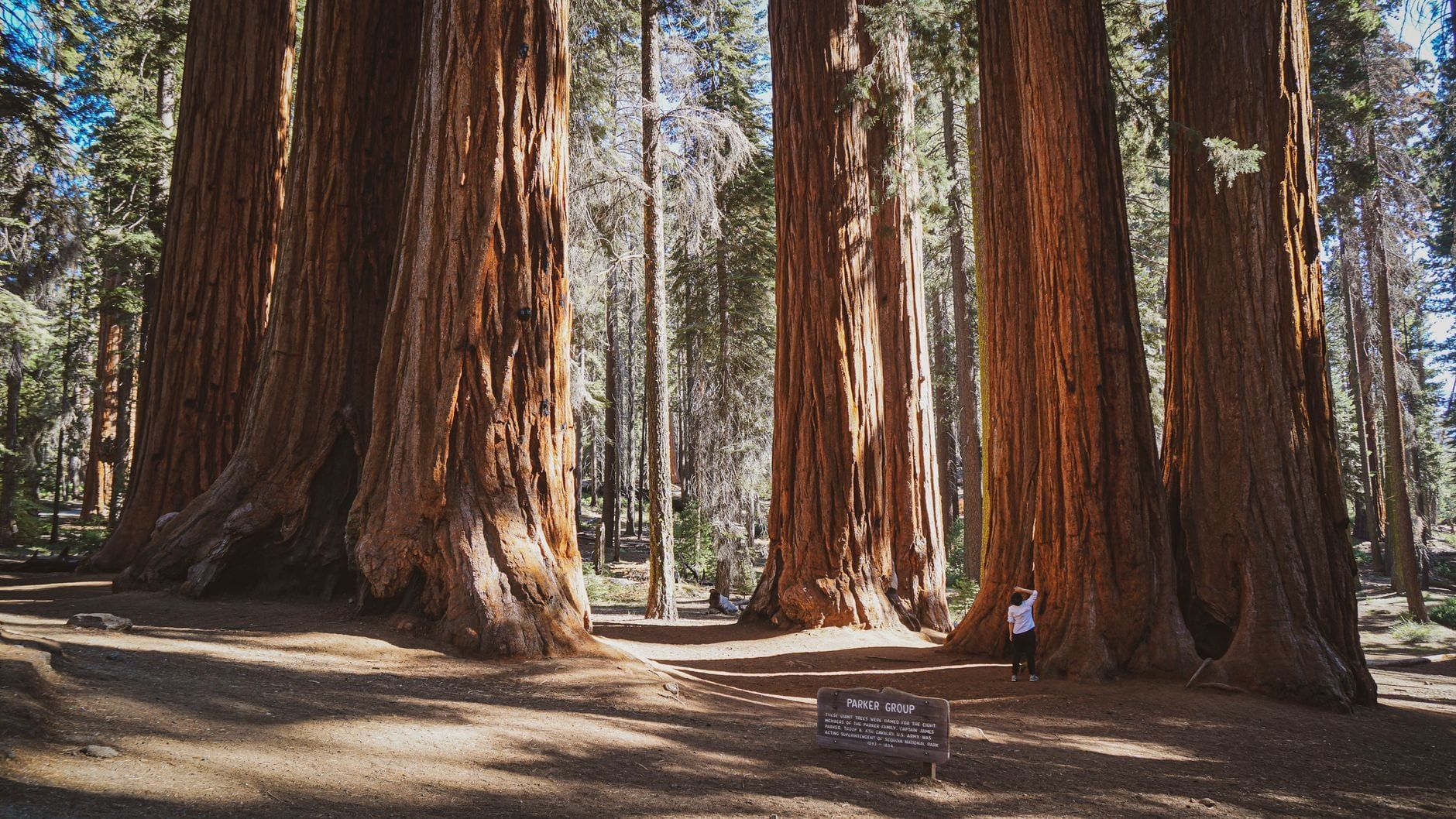
Sequoia National Park holds 866 miles of trail in the southern Sierra Nevada, but a first visit comes down to a dozen of them. The best hikes cluster in three areas: the Giant Forest groves around the General Sherman Tree, the Lodgepole–Wolverton corridor along the Generals Highway, and the low, hot Foothills near the Ash Mountain entrance. This guide groups the trails that way, so you can string several together in a morning instead of driving between scattered trailheads. For everything beyond the trail, our companion guide to things to do in Sequoia National Park covers the rest.
Sequoia's Best Hikes at a Glance
Nearly every hike worth doing starts between 6,500 and 7,500 feet, where there's noticeably less oxygen than at sea level. Treat each 'easy' label as one notch harder until you've slept a night at elevation. The stats below follow National Park Service figures — published blog numbers for the same trails disagree by as much as 25 percent, so use these as the baseline.
| Trail | Area / trailhead | Distance | Gain | Difficulty | Best for | Season |
|---|---|---|---|---|---|---|
| Big Trees Trail | Giant Forest Museum | 1.2 mi loop | Flat | Easy | Wheelchairs, kids, 30 minutes | Year-round |
| Congress Trail | General Sherman lot | ~2 mi loop | ~400 ft | Easy | Named giants, no crowds | May–Oct |
| Moro Rock | Moro Rock parking | 0.5 mi RT | ~300 ft | Moderate | Best view per effort, sunset | Late spring–fall |
| Tokopah Falls | Lodgepole Campground | 3.4 mi RT | ~530 ft | Moderate | Waterfall, river walk | Late May–June peak |
| Little Baldy | Generals Highway | 3.3 mi RT | ~800 ft | Moderate | Quiet 360° summit | June–Oct |
| Lakes Trail | Wolverton | 11.2 mi RT | ~3,230 ft | Hard | Alpine lakes, big day out | July–Sept |
If you only have one day, stay in the Giant Forest cluster and chain Sherman, the Congress Trail, Big Trees, and Moro Rock — our day-by-day Sequoia itinerary sequences them with shuttle timing. Two days lets you add Tokopah Falls and a viewpoint; three opens the Lakes Trail and Mineral King. Alta Peak is a day commitment on its own.
Giant Forest: General Sherman, Congress Trail & Big Trees
The Giant Forest is the largest unlogged sequoia grove on Earth, and these three short trails deliver its headline trees in half a day. In summer, arrive at the Giant Forest Museum area before 9 AM or you'll circle for parking; after that, the free shuttle connects every trailhead here.
General Sherman Tree Trail
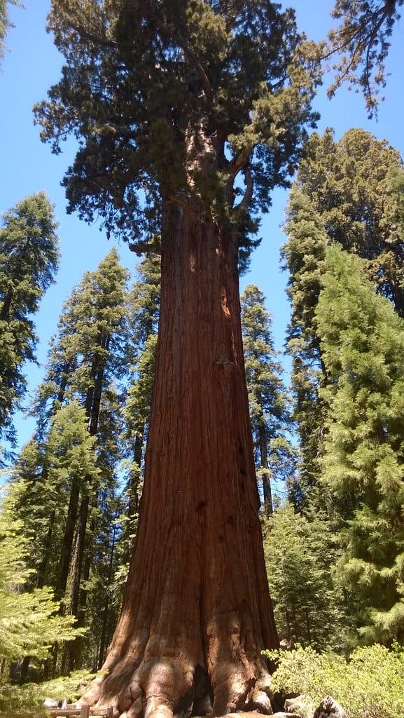
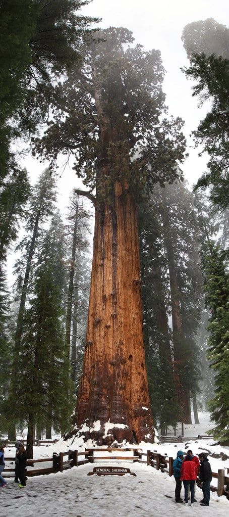
The main trail drops a paved half mile from the Wolverton Road lot to the largest tree on Earth, then climbs about 200 feet back up — and that climb at 6,800 feet is where visitors discover their cardio limits. The Sherman Tree stands 274.9 feet tall with a 102.6-foot ground-level circumference and roughly 52,508 cubic feet of trunk. A fence keeps everyone back, so expect to share the moment with a crowd from mid-morning on. Visitors with a disability placard get a separate lot and a paved path of about 500 feet to the tree, served by the summer shuttle.
Congress Trail
Skip back to the Sherman trailhead and continue past the fence line onto this roughly 2-mile loop, because the grove's best walking starts where most visitors turn around. The trail passes the House and Senate groups and the President Tree, one of the largest trees by volume anywhere. Ten minutes beyond the crowds you'll often have named giants to yourself. This is the single best hike in the park for first-timers.
Big Trees Trail
Across from the Giant Forest Museum, a 1.2-mile boardwalk loops around Round Meadow through a dense stand of sequoias. It's flat, wheelchair and stroller friendly, and takes about 30 minutes. Come at golden hour, when the meadow lights up and the museum crowds have gone.
A timed half-day in the Giant Forest
Here's the sequence that works: be through the Ash Mountain entrance by 8 AM, park at the Sherman lot (or the museum lot if you're early enough), and walk Sherman first while the trail is quiet. Then do the Congress loop, drive or shuttle to Big Trees, and finish at the museum before lunch. Doing it in reverse means fighting for parking at peak time. If you'd rather not read plaques all morning, a GPS-triggered audio tour narrates the grove's named trees and fire history as you walk.
Crescent Meadow, Trail of the Sequoias & the Quiet Groves
Once the headline lots fill, the grove's quieter side starts a mile east of the Sherman crowds — and it's where you're most likely to see a bear. These trails share the same forest with a fraction of the visitors.
Crescent Meadow Loop
John Muir called Crescent Meadow the 'gem of the Sierra,' and the 1.8-mile loop around it passes two of the park's odder landmarks: Tharp's Log, a cabin built inside a hollowed fallen sequoia, and the Chimney Tree, a fire-hollowed giant still standing. One catch: the road here closes to private vehicles during summer days, so you ride the free shuttle or come in the evening. This is also the trailhead of the 70-mile High Sierra Trail, so expect a few heavily loaded backpackers at the start.
Trail of the Sequoias
Link the Congress Trail with the Tharp's Log area on this roughly 7-mile loop from the Sherman trailhead and you'll pass entire stands of unfenced giants with almost nobody on the trail. It's the same forest as the headline loops, two valleys over. Budget a full morning and carry water — the loop dips and climbs more than its starting elevation suggests.
Soldier / Bear Hill Loop
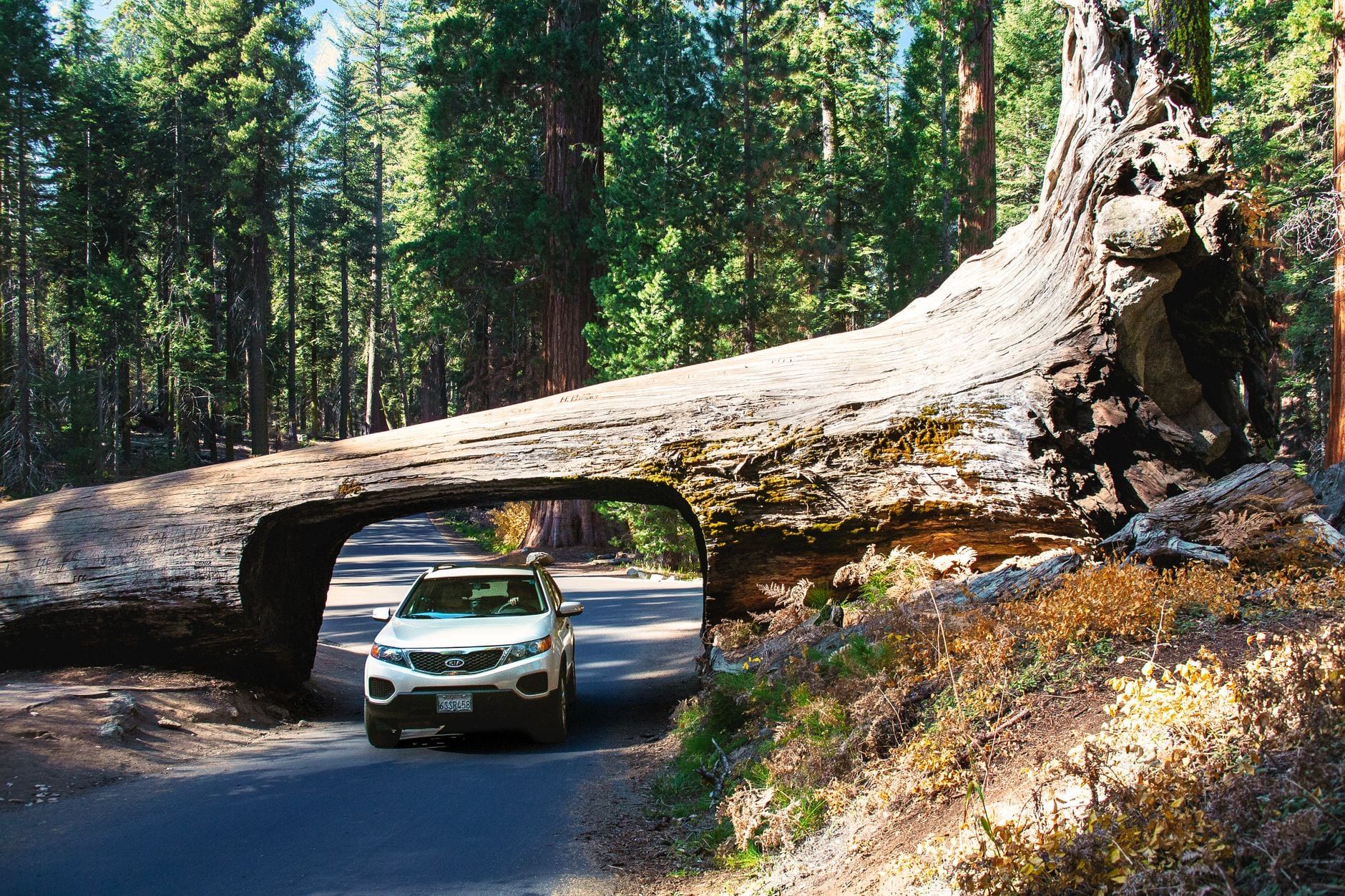
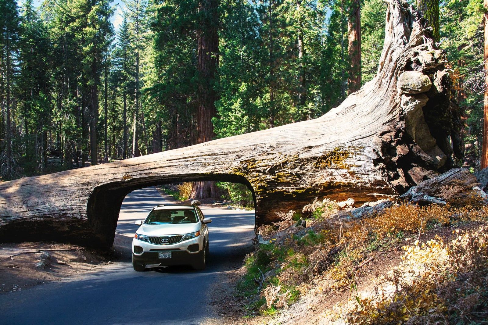
This 4.1-mile dirt loop with about 810 feet of gain is the quietest grove walk in the park and its most reliable black-bear habitat — hence the name. Partway around you can detour on foot to Tunnel Log, the fallen 1937 sequoia with a car-sized arch cut through it. Make noise on blind corners and store food properly; a bear that finds a lunch bag becomes a problem bear.
Hanging Rock & Beetle Rock
Two 15-minute additions bracket the quiet groves. Hanging Rock is a third of a mile off the Crescent Meadow area and perches a boulder over the canyon — a modest view with real drop-offs, so hold small kids close. Beetle Rock sits directly across the Generals Highway from the Giant Forest Museum and delivers a huge western panorama over the San Joaquin Valley on flat ground. Both work as low-effort sunset spots; bring a headlamp.
Moro Rock, Sunset Rock & Little Baldy: The Best View Hikes
Sequoia's best view-per-effort hikes are three short climbs to open granite. Each one feels harder than its stats suggest at 6,500-plus feet, and each earns its panorama within an hour of leaving the car.
Moro Rock
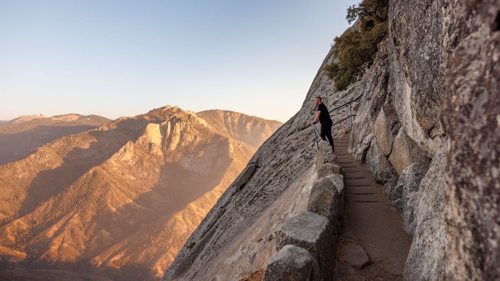
Roughly 400 stone steps climb 300 feet up the flank of this 6,725-foot granite dome, and the payoff is a full sweep of the Great Western Divide and the Kaweah River canyon. Half a mile round trip, done in 30 to 45 minutes. The stairway has exposed drop-offs and narrow sections that genuinely test a fear of heights — there's no shame in stopping at the first landing, which already clears the trees. In summer the road is shuttle-only during the day, but it reopens to private cars toward evening, which is why sunset here is the classic play.
Sunset Rock
From the Giant Forest Museum, this 2.6-mile round trip runs through forest burned in the 2021 fires — charred snags standing beside green sequoias, a startling contrast that's become one of the park's defining recent landscapes. The rock itself is a broad west-facing ledge. Time it so you're walking out by headlamp, and check that your batteries are charged before you go; there's no cell service to bail you out.
Little Baldy
Switchbacks climb 800 feet over 1.6 miles to an open granite dome with an unobstructed 360-degree view — on clear days you can pick out the Sierra crest far to the east. The trailhead is a small pullout on the Generals Highway, 3.3 miles round trip total, and it's noticeably quieter than anything in the Giant Forest. The polished slab at the summit is slick in spots; watch your footing near the edges.
Waterfall Hikes: Tokopah Falls & Marble Falls
The park has exactly two waterfall trails, and their seasons barely overlap: Tokopah belongs to late spring snowmelt, Marble Falls to late winter in the hot lowlands. Match the month and you'll get a show; miss it and you'll get a cliff.
Tokopah Falls
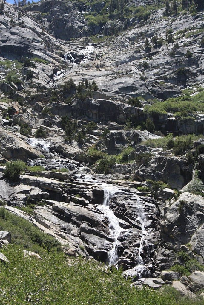
Tokopah Falls drops 1,200 feet down a granite staircase at the head of a glacial valley, and the trail to it is the park's best moderate walk: 3.4 miles round trip with about 530 feet of gain, starting from Lodgepole Campground and following the Marble Fork of the Kaweah River the whole way, past the sheer Watchtower spire. The flow calendar matters more than anything else on this hike — the falls peak from late May through mid-June and dwindle to a trickle by August. Come too early and snow hides the last stretch; come in September and you're hiking to a damp cliff.
Marble Falls
The park's other waterfall is its best off-season hike, because the trail starts at Potwisha in the Foothills at low elevation and stays snow-free when the groves are buried. It's 6.3 miles round trip with about 1,500 feet of gain, best from late winter through early spring, with April wildflowers along the way. Skip it in summer, when the Foothills routinely pass 100°F — the canyon holds heat all afternoon. Poison ivy and tall grass line parts of the route, so wear long pants and stay on the tread.
Strenuous Day Hikes: Lakes Trail & Alta Peak
Two full-day alpine hikes start from the main Generals Highway corridor, both snow-free only from about July into September. Bring real legs, water, and an early alarm.
Lakes Trail to Heather, Emerald & Pear Lake
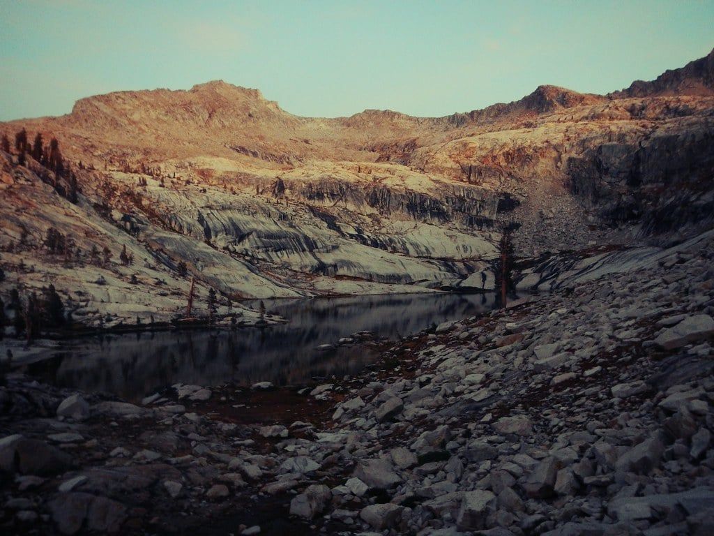
From Wolverton, the Lakes Trail climbs past three glacial lakes — Heather, Emerald, and Pear — on an 11.2-mile round trip with roughly 3,230 feet of gain. The signature section is the Watchtower, a granite shoulder with dramatic ledges over the Tokopah Valley; the park closes it whenever ice is present, and the detour over 'the hump' is longer and duller, so check conditions at Lodgepole before committing. Short on legs or daylight? Turn around at Heather Lake for a 7-ish-mile day that gets you most of the scenery. Start by 8 AM either way.
Alta Peak
At 11,204 feet, Alta Peak gives one of the finest panoramas in the Sierra — the Great Western Divide on one side, the Kern Canyon and the Whitney region on the other. It costs you: 13.8 miles round trip, 3,920 feet of gain, eight to ten hours on the trail via Panther Gap. The final pitch above Alta Meadow is a slog over loose granite, and altitude above 10,000 feet flattens even strong hikers. Camp at Mehrten Meadows or Alta Meadow with a wilderness permit to split the climb. If a day trip still appeals, spend your first night at Lodgepole or Wuksachi, drink more water than seems reasonable, and start at dawn.
Backpacking: High Sierra Trail, Mineral King & Mount Whitney
For overnight hikers, Sequoia's backcountry is the real draw — this section is a set of pointers to start planning, not a full guide.
High Sierra Trail
The park's signature backpacking route runs about 70 miles from Crescent Meadow to the summit of Mount Whitney, usually done in six or seven days. The headline sections are Bearpaw Meadow's overlook and the crossing of 11,000-foot Kaweah Gap, where the trail drops into a basin most people never see. Permits go fast: reserve up to six months ahead on Recreation.gov. Walk-up permits run $15 plus $5 per person at trailhead ranger stations, but the popular entry points fill early.
Mineral King
A winding 25-mile dead-end road — closed by snow roughly November through May — ends at this high glacial valley, where day hikes reach Eagle Lake and the Monarch Lakes beneath jagged peaks, with Sawtooth and Franklin Lakes for overnights. One local ritual matters: Mineral King's marmots chew car hoses and wiring, and rangers advise wrapping your undercarriage with a tarp before parking. Ask at the ranger station for the current wrapping station and technique.
Mount Whitney
The tallest peak in the contiguous United States at 14,494 feet sits inside Sequoia's boundary, reached by a 22-mile round trip with more than 6,100 feet of gain from Whitney Portal on the range's east side. Permits are awarded by lottery — apply in February for summer dates, and expect slim odds. The no-lottery alternative is Mount Langley, a nearby 14er with its own roadwalk approach and far more permit availability. Either way, this is a project, not a hike you add to a family trip.
Planning Your Sequoia Hikes
A few logistics decide whether a given hike is actually feasible on your dates — season by elevation, road rules, and the shuttle calendar. Here's the short version.
When to go
The main hiking season runs roughly May through October. High-country trails — the Lakes Trail, Alta Peak, everything in Mineral King — are only reliably snow-free from July into September, while grove trails in the Giant Forest open earlier and close later. Waterfall flow peaks in late spring. For month-by-month detail on weather and crowds, see our guide to the best time to visit Sequoia.
Winter hiking
Winter narrows the menu rather than closing it. The Big Trees boardwalk, the Congress loop, and snow-dusted grove walks stay feasible — sequoias with fresh snow on their crowns are worth the drive on their own — and the Foothills trails, including Marble Falls, are at their best. The Generals Highway stays open year-round but tire chains are often required, and Mineral King Road plus the higher trailheads close with the first heavy snow, usually by mid-November. Our winter guide to Sequoia covers chains, closures, and what's realistic.
Fees, shuttles, and access rules
Entry costs $35 per vehicle for a pass valid seven days in both Sequoia and Kings Canyon; no timed-entry reservation is required, but entrance stations take card payment only. An $80 America the Beautiful pass covers all national parks for a year. Current details are on our hours and fees page. Free in-park shuttles connect the Giant Forest and Lodgepole trailheads from late May through early September, with limited holiday-season service — that shuttle is what makes the summer road closures on Moro Rock and Crescent Meadow Road painless.
Getting there and where to base
Fresno Yosemite International (FAT) is the closest major airport, about 1.5 hours from the Foothills entrance and roughly two hours from the Giant Forest. Most Southern California visitors drive up in about four hours — our Los Angeles to Sequoia route guide breaks down the drive and stops. For hiking, base at Lodgepole or Wuksachi to be minutes from the main trailheads; Three Rivers, the gateway town below Ash Mountain, is cheaper but puts you 45 winding minutes from the groves. Fill the gas tank either way — there's no fuel inside the park except seasonally at Stony Creek.
On-trail rules and safety
A few rules catch visitors off guard, so learn them before the trailhead:
- No pets on any park trail, anywhere, on any leash.
- Bear spray is illegal in California national parks — black bears only here.
- Store all food and scented items in the provided bear lockers.
- Day-hike groups cap at 25 people; no permit needed except Whitney.
- No cell service on trails — download offline maps before you go.
Carry more water than you think you need at these elevations, and pack layers: a grove morning at 40°F can be a 90°F foothill afternoon by the time you descend. The rivers are glacier-fed and stay dangerously cold through spring, so keep kids out of them.
FAQs About Hiking in Sequoia National Park
The questions first-time Sequoia hikers ask most, answered in brief — each points back to the trail section above for detail.
Frequently asked questions
What is the best hike in Sequoia National Park for first-timers?
The Congress Trail, a roughly 2-mile loop from the General Sherman trailhead. It passes the House and Senate groups and the President Tree with a fraction of the Sherman crowds. Pair it with the Sherman Tree itself and the Big Trees boardwalk for the classic half-day, and add Moro Rock if you have energy left.
How many days do you need to hike Sequoia National Park?
One full day covers the Giant Forest icons — Sherman, the Congress Trail, Moro Rock, and Crescent Meadow. Two to three days adds Tokopah Falls, Little Baldy, and a morning at Mineral King, plus breathing room. The Lakes Trail, Alta Peak, and any backpacking route need their own dedicated day or more.
Do I need a permit to hike in Sequoia National Park?
No permit is required for day hikes, with one exception: Mount Whitney. Overnight trips need a wilderness permit, reservable up to six months ahead on Recreation.gov or issued as walk-ups at ranger stations for $15 plus $5 per person. Day-hike groups are capped at 25 people.
Can you hike Moro Rock if you're afraid of heights?
Honestly, it's a challenge — roughly 400 stone steps with exposed drop-offs and narrow railings. The first landing already clears the trees, so a partial climb still earns a view. For big panoramas with flat footing, use Sunset Rock, Hanging Rock, or Beetle Rock instead.
Are dogs allowed on hiking trails in Sequoia?
No. Pets are banned from every trail in Sequoia and Kings Canyon and are only allowed in developed areas, on roads, and in campgrounds, leashed at no more than six feet. They also can't be left in vehicles unattended, so plan trips around your dog.
Do you need bear spray in Sequoia National Park?
No — and you can't carry it: bear spray is prohibited in California national parks. Sequoia has black bears only. Store food in the bear-proof lockers, make noise on quiet trails like the Soldier/Bear Hill loop, and view any bear from a long distance.
Can you hike Sequoia National Park in winter?
Yes, with a smaller menu. The grove trails — Big Trees, the Congress loop, the walk to Sherman — stay open, and sequoias in fresh snow are the park at its best. The Foothills trails, including Marble Falls, are often at their prime. Carry tire chains, expect Mineral King Road to be closed, and check road conditions before driving up.
How do you avoid crowds on Sequoia's popular hikes?
Enter the park early and park in the Giant Forest area before 9 AM, ideally by 8. Continue onto the Congress Trail instead of stopping at the Sherman fence line, ride the free summer shuttle instead of hunting for parking, and save Moro Rock and Sunset Rock for sunset, when the shuttle-only roads reopen to private cars.