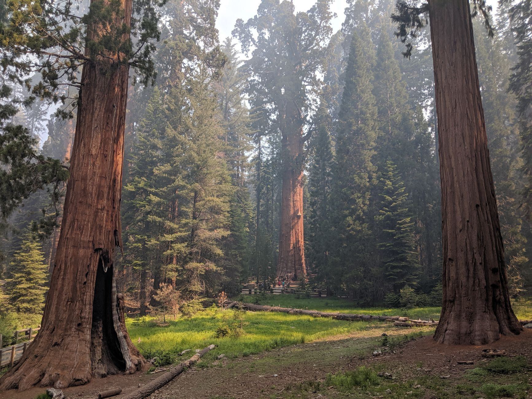
It's 400 miles and roughly 6.5 to 7.5 hours of driving from Las Vegas to Sequoia National Park — one of the longest single-day pushes to any of California's major parks. There's no shortcut from the east, either: the Sierra Nevada walls off that side completely, so everyone enters from the west via Highway 198 or Highway 180. That geography shapes the whole trip, from whether a day trip makes sense (it doesn't) to where you sleep, fuel up, and buy your pass.
How Far Is Sequoia from Las Vegas? Distance and Drive Time
Count on 400 miles and six and a half to seven and a half hours behind the wheel, before a single bathroom break. The National Park Service lists the drive from Las Vegas to the Ash Mountain Entrance at 400 miles (644 km) and 6 hours 30 minutes; real-world traffic usually pushes that closer to seven and a half. Add lunch, a fuel stop, and a possible line at the gate, and you're looking at a full eight to ten hours door to door.
One number that trips people up: the entrance is not the trees. Ash Mountain sits at about 1,700 feet in the foothills, and from there Generals Highway climbs for another hour to an hour and a half before you reach Giant Forest. The road is steep, narrow, and stitched with hairpins. Sightseeing speed, not highway speed.
Don't waste time hunting for a faster line across the mountains. No road crosses Sequoia or Kings Canyon from east to west — Highway 198 and Highway 180 are the only gateways, both on the western flank. Every route from Las Vegas wraps around the southern end of the Sierra, through the Mojave and the Central Valley. GPS can't fix geography. For full directions to Sequoia National Park, including the northern approach, the park service's own driving page is the authority.
The leg times tell the story of the day: Las Vegas to Bakersfield is about 4.5 hours (280 miles), and Bakersfield to the Ash Mountain gate is roughly 2.5 hours more, through Visalia and Three Rivers. Wanderlog clocks the direct drive at 394 miles and 7 hours 36 minutes in typical traffic, which squares with the official figure once you account for the slow final climb.
Best Route from Las Vegas to Sequoia National Park
Here is the turn-by-turn, exactly as the park service publishes it. Take I-15 south out of Las Vegas toward Los Angeles. At exit 179, leave the interstate for CA-58 west toward Tehachapi and Bakersfield — this leg crosses the mountains and drops into the southern San Joaquin Valley. From Bakersfield, follow CA-99 north toward Fresno and exit at 96 onto CA-198 east toward Visalia. CA-198 runs through Visalia and the gateway town of Three Rivers, dead-ending at the Ash Mountain Entrance Station.
Two GPS settings matter before you leave the Strip. First, set your destination to a specific landmark — "Giant Forest Museum" or "Ash Mountain Entrance" — rather than "Sequoia National Park." The park service warns that generic park destinations can route you around entrance stations and onto remote, unpaved, seasonally gated, or 4WD-only roads. Second, turn off the "avoid tolls" setting; left on, it can push you onto those same back roads.
Driving something long? Generals Highway has hard advisories above the foothills: vehicles over 24 feet are not advised between Foothills Visitor Center and Potwisha Campground, and over 22 feet between Potwisha and Giant Forest Museum. If you're in a big RV or pulling a trailer, enter via CA-180 through Fresno and the Big Stump entrance instead, then approach the sequoia groves from the north.
If you'd rather trade Valley farmland for river canyon, there's a scenic alternative. Branch off at CA-14 and take CA-155 over Walker Pass through Kernville and Lake Isabella, rejoining the park approach from the southwest. It's slower — count on adding real time, not minutes — but the Kern River stretch is the prettiest driving on any version of this trip. Do it when you have an afternoon to spare, not on your one shot at the trees.
Fuel and cell service deserve respect on the middle of this route. Between Barstow and Bakersfield there are long stretches of CA-58 with almost nothing — few towns, few stations, patchy phone signal. Top off in Barstow and again in Bakersfield and you'll never think about it again.
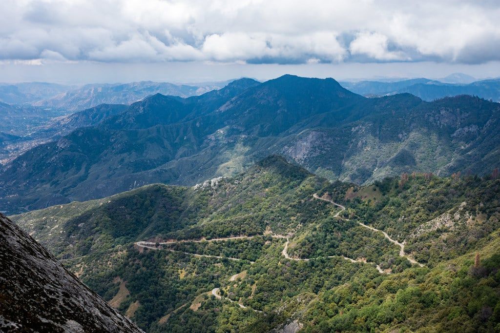
Best Stops Between Las Vegas and Sequoia
The fastest corridor is oddly rich in stops worth making, as long as you stick to what's actually on the route. Everything below sits on or a few minutes off I-15, CA-58, and CA-198, in driving order, with rough timing from Las Vegas so you can plan breaks around it.
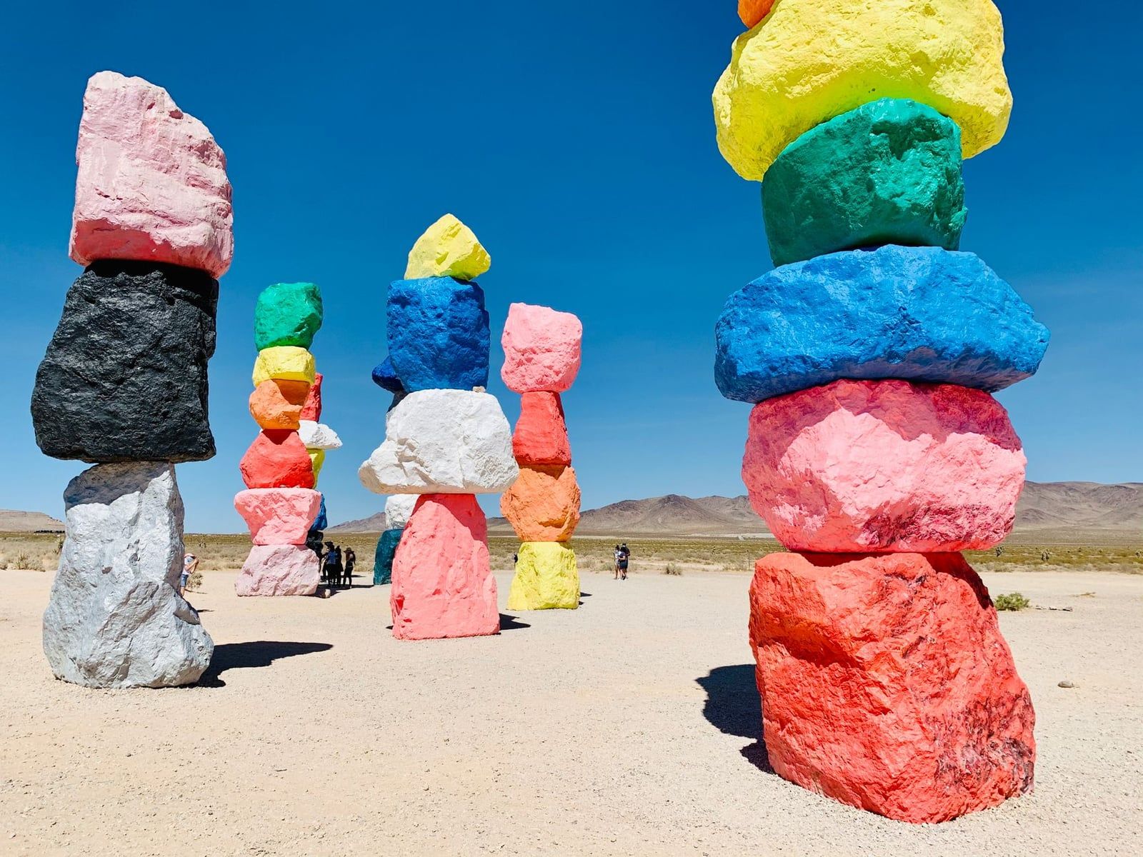
Seven Magic Mountains (25 minutes in)
Seven painted boulder totems, up to 35 feet tall, stand in the desert just south of the Strip right beside I-15. It's free, it takes ten minutes, and morning light is when the colors pop — by mid-afternoon the Mojave sun flattens them and the parking lot heats up. A painless way to break up the first leg.
Baker: thermometer, jerky, and cheap gas (about 90 minutes in)
Baker is the last real service cluster before the long empty stretch, so treat it as a fuel and snack checkpoint even if nothing else tempts you. The World's Tallest Thermometer — 134 feet, commemorating Death Valley's 134°F world record set in 1913 — towers over the main drag. Alien Fresh Jerky, next door in spirit if not in taste, covers the road-trip provisions. Fill the tank here; the next reliable cheap fuel is Barstow, and after that Bakersfield.
Barstow and Calico Ghost Town (about 2.5 hours in)
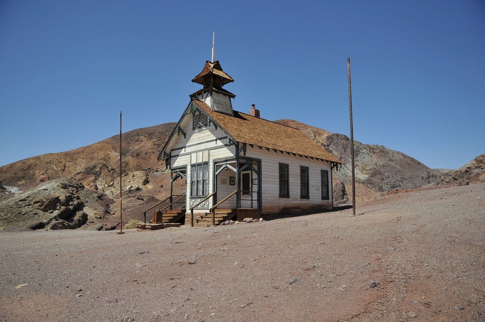
Calico is the one stop on this drive worth a genuine detour — a restored 1880s silver-mining town, now a San Bernardino County regional park, a few minutes off I-15 near Barstow. Old mine shafts, wooden walkways, and enough kitsch to keep kids happy for an hour. If you just need to stretch your legs, the Tanger Outlets at Barstow sit directly off the interstate and do the job in fifteen minutes.
Bakersfield: the lunch anchor (about 4.5 hours in)
Bakersfield is where this drive eats. Murray Family Farms' Big Red Barn sits just off CA-99 on the city's outskirts, with pick-your-own fruit and a petting garden that rescues a road trip with restless kids. In town, Buck Owens' Crystal Palace serves dinner with live country music — Bakersfield's signature export. If you'd rather keep moving, every chain imaginable lines the CA-99 corridor. Either way, this is the natural halfway meal.
The final leg: Exeter, Visalia, and Three Rivers
After Bakersfield the landscape turns to orange groves. Exeter's downtown murals make a five-minute diversion if you're passing through on a lazy pace. Visalia is the last full-service city — the place for a real supermarket run, a pharmacy, and a final cheap tank of gas. Three Rivers, at the end of CA-198, is the gateway village: a handful of river-front restaurants, the last fuel before the park, and the last cell signal that behaves. Stock up like there's nothing past it, because functionally there isn't.
Where to Break the Drive: Overnight Stops and Lodging
Here's the honest math: the round trip from Las Vegas is 13–15 hours of driving. That leaves two, maybe three hours among the biggest trees on Earth. A same-day there-and-back isn't a park visit; it's a commute with sequoias at the midpoint. So the real question isn't whether to overnight — it's where, and in what trip shape. Three work well.
Option A: One long day
Leave Las Vegas by 6 or 7 a.m., cross the Mojave before the heat, eat lunch in Bakersfield around 11, and reach Giant Forest by mid-afternoon. Then keep going — north to Yosemite, or wherever your larger loop leads. This shape works only when Sequoia is the midpoint of a bigger trip, not the destination. As an out-and-back day trip, skip it.
Option B: The overnight split
The comfortable default. Drive to Bakersfield (4.5 hours) or, better, push the extra two hours to Visalia or Three Rivers so you wake up close to the gate. In the parks, Wuksachi Lodge is the main in-park option; John Muir Lodge sits in Kings Canyon's Grant Grove, and Montecito Sequoia Lodge sits between the two parks. In Three Rivers, the Buckeye Tree Lodge and The River Inn put you on the water 30–45 minutes from the entrance. Book summer weekends far ahead — these fill early.
Dining anchors, in case you're planning meals: in Bakersfield, the 24th Street Café for an old-school breakfast and the Padre Hotel for dinner. In Three Rivers, Ol' Buckaroo and the River View Restaurant cover dinner, Sierra Subs packs trail lunches, and Reimer's Candies handles the drive home. For a full Sequoia National Park itinerary, two days is the sweet spot — one for Giant Forest, one for the rest.
Option C: The multi-park loop
Many Vegas travelers are actually building a Southwest loop, and this is the shape for them. Drive two hours northwest to Death Valley (about 110 miles) and spend the afternoon at Badwater Basin and Artist's Palette — the lowest, hottest terrain in the country, and a wild contrast to where you're headed. Overnight in Ridgecrest or Bakersfield, then drive the remaining five hours or so (270 miles) to Sequoia the next day. Our Death Valley to Sequoia guide covers that second leg in detail.
One footnote on transit: there is no direct bus. Piecing together connections through Bakersfield and Visalia runs nearly twelve hours to Giant Forest. If you can't drive, flying into Fresno and renting a car beats the bus by hours.
Park Logistics: Fuel, Fees, Entrances and Waits
This is the part no road-trip roundup tells you, and the part that can derail a day. Start with fuel: there are no gas stations and no EV chargers inside either park. A seasonal station at Stony Creek Village, between the two parks, is the only fuel anywhere in that stretch, and you shouldn't plan around it. Fill up in Three Rivers — or Visalia if you're entering from the north — and treat a full tank as your ticket in.
Entrance fees are straightforward, and one pass covers both parks:
| Pass type | Cost | Notes |
|---|---|---|
| Private vehicle | $35 | Covers everyone in the car |
| Motorcycle | $30 | Up to 2 motorcycles, 4 people |
| On foot or bicycle | $20 per person | Age 16 and up |
| Annual park pass | $70 | Valid one year from purchase |
Two payment details catch visitors out. Entrance stations don't take cash — credit, debit, or mobile pay only. And an America the Beautiful pass ($80) covers entry if you'll hit more than a couple of national parks this year. Current details live on our hours and fees page.
Which entrance? Ash Mountain, at the end of CA-198 through Three Rivers, is yours from Las Vegas — it's the closest gate to Giant Forest and General Sherman. Big Stump, on CA-180 out of Fresno, is the better choice for longer vehicles or anyone coming from the north; the two entrances connect inside the park via Generals Highway. Flying instead? Fresno Yosemite International is about an hour and three-quarters from the Sequoia entrance; tiny Visalia Municipal is closer still.
Waits, finally. On summer Fridays, Saturdays, and holidays from Memorial Day to Labor Day, entrance-station lines stretch long. Buy your pass online in advance or arrive before 9 a.m. The line is the single most predictable delay on this entire 400-mile drive.
Best Time of Year to Make the Drive
This route crosses some of the hottest terrain in North America and finishes at 6,000–7,000 feet, where snow governs the calendar. Each season trades something.
Spring (March–May) may be the best all-around window: the desert wildflowers are out on the CA-14 leg if you take the scenic route, foothill waterfalls run hard, and the driving is mild. Late spring can still throw a snowstorm, and rivers run fast and cold — keep kids back from the water.
Summer (June–August) means crossing the Mojave at temperatures that regularly top 110°F. Leave Las Vegas at dawn and the desert leg is merely hot rather than miserable. Giant Forest itself stays pleasant at elevation, but entrance lines peak, lodges book out, and the free shuttles run full. Comfort up high, congestion at the gate.
Fall (September–November) is the sweet spot for the drive itself: cooler desert crossings, thinning crowds, and the first color along Generals Highway. October pairs a civilized Mojave with quiet groves. If your dates are flexible, aim here.
Winter (December–February) is doable but demands respect. Tire chains may be required on park roads during snowy weather — carry them even in a four-wheel-drive, and check the park's road-status line (559-565-3341) the morning you drive up. Daylight is short, which means doing the CA-58 or CA-99 legs in the dark on the return. Our best time to visit Sequoia guide goes deeper on month-by-month conditions.
Top Things to Do in Sequoia Once You Arrive
You drove 400 miles for a handful of sights. Here's the priority order for the hours you actually have — the full things to do in Sequoia list runs much longer.
General Sherman Tree and the Congress Trail
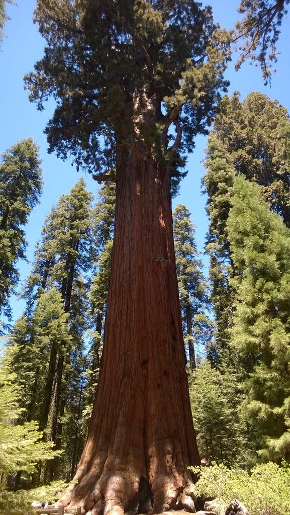
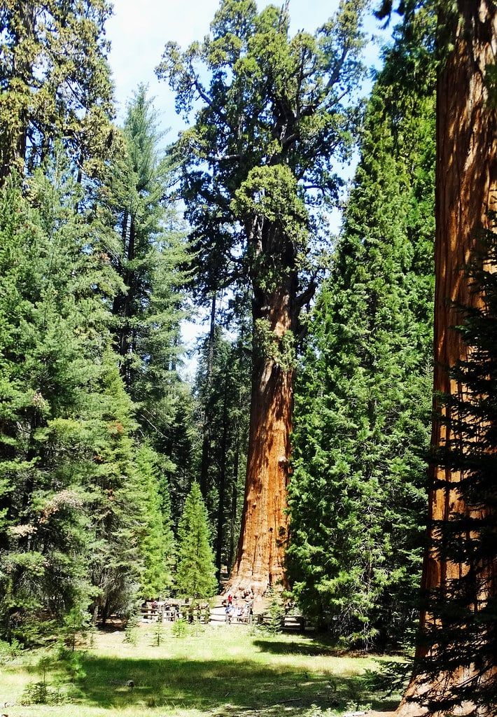
The largest tree on Earth by volume — 52,508 cubic feet, 274.9 feet tall, over 2,000 years old — stands in Giant Forest, reached by a paved half-mile trail from the main lot. Paved matters here: the path is wheelchair-accessible with benches along the way. From the Sherman area, the Congress Trail loops about two miles past the President Tree and other named giants. If you do nothing else in the park, do this loop.
Moro Rock and Tunnel Log
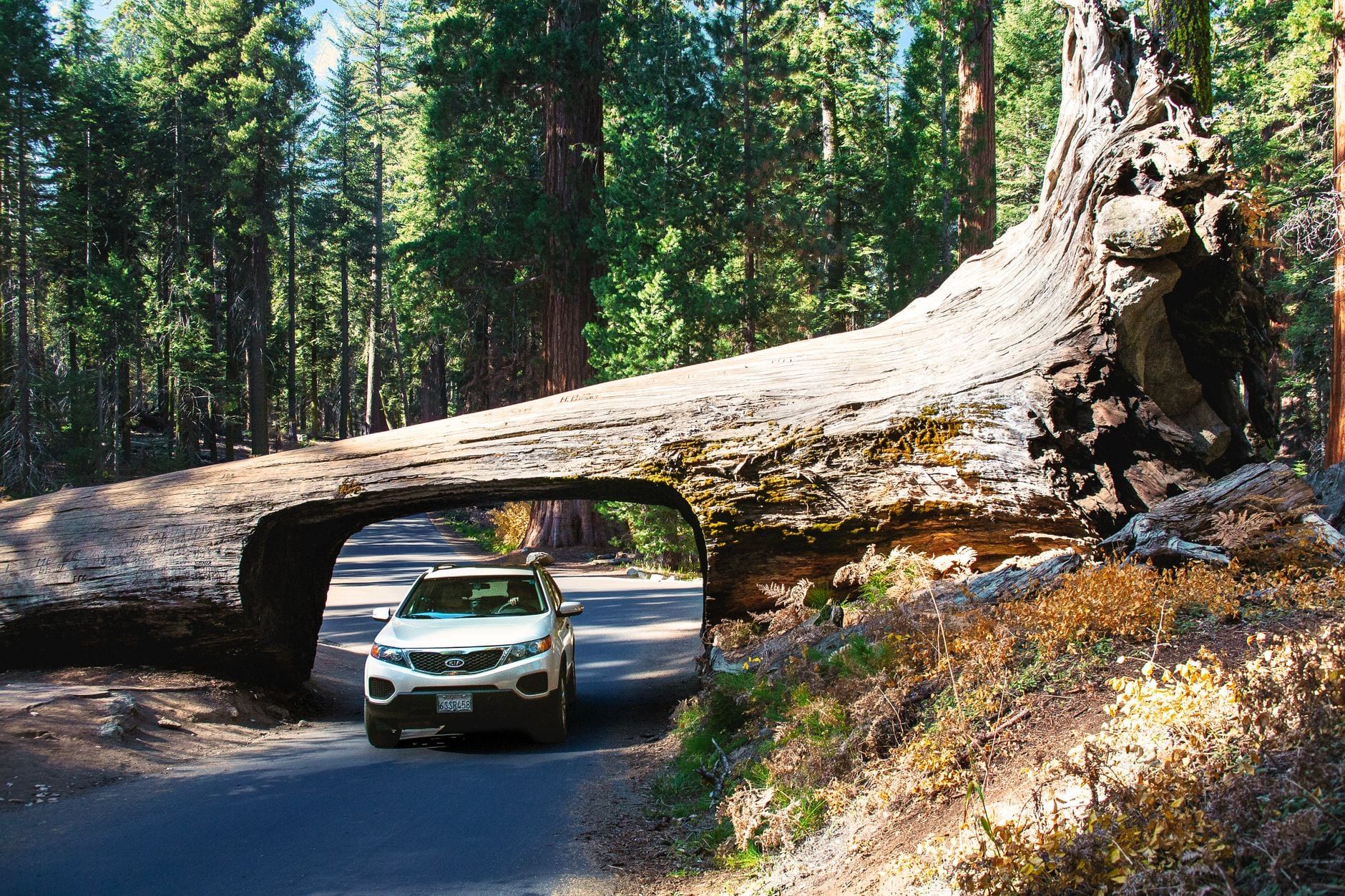
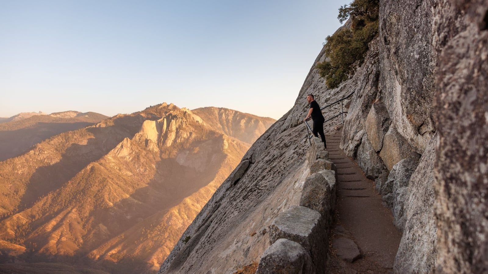
Moro Rock is a 6,725-foot granite dome with roughly 400 steps carved into its flank; from the top you get the Great Western Divide on one side and the Kaweah River canyon dropping away on the other. Sunrise and sunset thin the crowds and sharpen the light. Down on the Crescent Meadow road, Tunnel Log is a fallen sequoia — it came down in 1937 — with a car-sized hole cut through the trunk. Note that on summer weekends the free Giant Forest shuttle may be the only way in, when the spur road closes to private vehicles.
Crescent Meadow and Big Trees Trail
John Muir called Crescent Meadow the "Gem of the Sierra," and early summer backs him up — wildflowers ring a lush meadow hemmed by sequoias on an easy loop. For strollers and wheelchairs, the Big Trees Trail at Giant Forest Museum is the flat, paved option, with interpretive panels doing the explaining. Neither takes more than 45 unhurried minutes.
Crystal Cave (if you planned ahead)
A marble cavern with stalactites and stalagmites, toured with rangers in about 50 minutes at a constant 48°F. Two catches: tickets are sold in advance in Three Rivers, never at the cave, and the entrance sits down a steep half-mile trail from the parking area — you climb it back out. Our Crystal Cave guide has booking details.
If you're staying overnight
An extra night buys the park at its best hours: sunrise from Beetle Rock, when the Kaweah canyons fill with fog below you, or sunset from Sunset Rock a short walk from Giant Forest Museum. In winter, the Wolverton area turns into the park's snow-play and cross-country zone — bring chains, bring layers, and check the road status before committing to the climb.
Frequently asked questions
How long is the drive from Las Vegas to Sequoia National Park?
About 400 miles and 6.5–7.5 hours of driving. The park service lists 400 miles and 6 hours 30 minutes to the Ash Mountain Entrance via I-15 S, CA-58 W, CA-99 N, and CA-198 E; typical traffic pushes it to about seven and a half hours. Budget 8–10 hours door to door with stops, plus another hour to an hour and a half on Generals Highway to reach Giant Forest.
Can you do Sequoia National Park as a day trip from Las Vegas?
Not realistically. No road crosses the parks from east to west, so the round trip is roughly 13–15 hours of driving, leaving only 2–3 hours in the park. Plan at least one overnight; two to three days lets you see both Sequoia and Kings Canyon properly.
Is there gas or EV charging in Sequoia National Park?
No. There are no gas stations or EV chargers inside the parks — only a seasonal station at Stony Creek Village between the two parks, which you shouldn't count on. Fill up in Three Rivers or Visalia before the climb.
How much does it cost to enter Sequoia National Park?
$35 per private vehicle, valid 1–7 days and covering both Sequoia and Kings Canyon plus the Hume Lake district. Motorcycles pay $30, pedestrians and cyclists $20 per person (16+), and the annual park pass is $70. Entrance stations accept card and mobile payment only, not cash.
What's the best route from Las Vegas to Sequoia National Park?
I-15 south toward Los Angeles, exit 179 onto CA-58 west toward Bakersfield, CA-99 north toward Fresno, then exit 96 onto CA-198 east through Visalia to the Ash Mountain Entrance — the official park service route, about 400 miles and 6.5 hours.
Do I need tire chains to drive to Sequoia in winter?
Possibly. The park service requires chains on park roads during snowy weather, which can happen anytime in winter and spring. Carry them, and check the park's road-status line (559-565-3341) the morning you plan to drive Generals Highway.
Where should I stop between Las Vegas and Sequoia?
On the fastest corridor: Seven Magic Mountains about 25 minutes from the Strip; Baker's World's Tallest Thermometer and Alien Fresh Jerky; Calico Ghost Town near Barstow; Bakersfield for lunch (Murray Family Farms, Buck Owens' Crystal Palace); then Visalia and Three Rivers at the gate.
What's the closest airport to Sequoia National Park?
Fresno Yosemite International (FAT), about an hour and three-quarters from the Sequoia entrance. Visalia Municipal (VIS) is smaller and closer. Most Las Vegas travelers drive the 400 miles rather than fly.